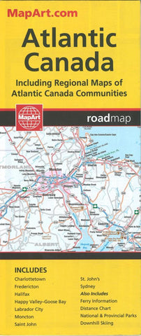
Atlantic Canada Road Map by Canadian Cartographics Corporation
The Atlantic Provinces are New Brunswick, Prince Edward Island, Nova Scotia, Newfoundland and Labrador. The map is two sided with Newfoundland & Labrador on one side the rest of the Province on the other. There are insets of Charlottetown, Fredericton, Halifax, Moncton, Saint John, St. Johns and Sydney. A distance chart and ferry information is included for Atlantic Canada.
- Product Number: 2213788M
- Product Code: CCC_ATL_CAN
- ISBN: 9781553682653
- Year of Publication: 2018
- Folded Size: 9.45 x 3.94 inches
- Unfolded Size: 26.38 x 35.04 inches
- Map type: Folded Map
- Geographical region: Canada


