
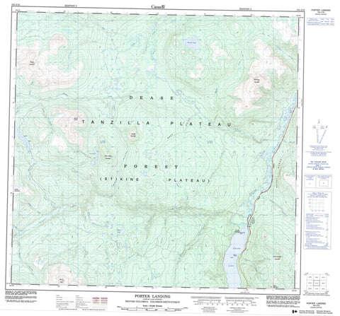
104J16 Porter Landing Canada topo map, 1:50,000 scale
104J16 Porter Landing NRCAN topographic map.
Includes UTM and GPS geographic coordinates (latitude and longitude). This 50k scale map is suitable for hiking, camping, and exploring, or you could frame it as a wall map.
Printed on-demand using high resolution, on heavy weight and acid free paper, or as an upgrade on a variety of synthetic materials.
Topos available on paper, Waterproof, Poly, or Tyvek. Usually shipping rolled, unless combined with other folded maps in one order.
- Product Number: NRCAN-104J16
- Parent Topo: TOPO-104J
- Map ID also known as: 104J16
- Unfolded Size: Approximately 26" high by 36" wide
- Weight (paper map): ca. 55 grams
- Map Type: POD NRCAN Topographic Map
- Map Scale: 1:50,000
- Geographical region: British Columbia, Canada
Neighboring Maps:
All neighboring Canadian topo maps are available for sale online at 1:50,000 scale.
Purchase the smaller scale map covering this area: Topo-104J
Spatial coverage:
Topo map sheet 104J16 Porter Landing covers the following places:
- Sawmill Point - Steamboat Point - One Mile Point Indian Reserve 1 - Réserve indienne One Mile Point 1 - Adsit Lake - Bend Lake - Hankin Lake - Hunters Lake - Martin Lake - Porcupine Lake - Portage Lake - Beady Range - Cassiar Mountains - French Range - Mount Coulahan - Mount Defot - Mount Rath - Northwest Mountain - Porter Landing Mountain - Red Ledge Mountain - Slough Mountain - Stake Mountain - Vowel Mountain - Stikine Plateau - Adsit Creek - Beady Creek - Beaver Creek - Berry Creek - Boulder Creek - Bull Creek - California Creek - Canyon Creek - Coulahan Creek - Dease River - Deep Gulch - Defot Creek - Delure Creek - Goathorn Creek - Gold Creek - Grizzly Bear Creek - Hankin Creek - Mosquito Creek - North Creek - Old Bell Creek - Packer Tom Creek - Porcupine Creek - Quartz Creek - Rath Creek - Rose Creek - Seywerd Creek - Spring Creek - Swamp Creek - Thibert Creek - Vowel Creek - Dease Lake - Defot - Porter Landing - Bear Gulch - Five Mile Gulch


