
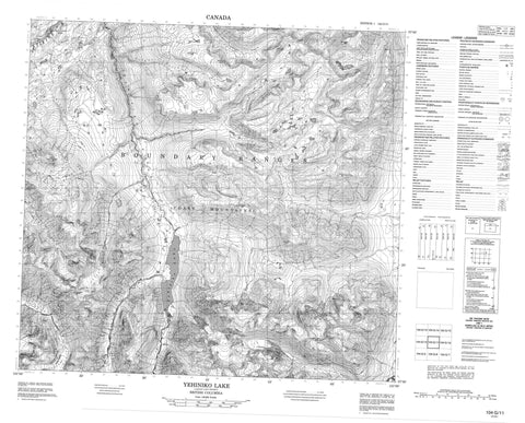
104G11 Yehiniko Lake Canada topo map, 1:50,000 scale
104G11 Yehiniko Lake NRCAN topographic map.
Includes UTM and GPS geographic coordinates (latitude and longitude). This 50k scale map is suitable for hiking, camping, and exploring, or you could frame it as a wall map.
Printed on-demand using high resolution, on heavy weight and acid free paper, or as an upgrade on a variety of synthetic materials.
Topos available on paper, Waterproof, Poly, or Tyvek. Usually shipping rolled, unless combined with other folded maps in one order.
- Product Number: NRCAN-104G11
- Parent Topo: TOPO-104G
- Map ID also known as: 104G11
- Unfolded Size: Approximately 26" high by 36" wide
- Weight (paper map): ca. 55 grams
- Map Type: POD NRCAN Topographic Map
- Map Scale: 1:50,000
- Geographical region: British Columbia, Canada
Neighboring Maps:
All neighboring Canadian topo maps are available for sale online at 1:50,000 scale.
Purchase the smaller scale map covering this area: Topo-104G
Spatial coverage:
Topo map sheet 104G11 Yehiniko Lake covers the following places:
- Yehiniko Lake - Amphitheatre Ridge - Boundary Ranges - Chaîne Côtière - Coast Mountains - Crocus Mountain - Dutch Charlie Hill - Helveker Mountain - Mount Helveker - Mount Walter - Nightout Mountain - Stickleback Ridge - The Pinnacle - Tshiyone Mountain - Regional District of Kitimat-Stikine - Dutch Charlie Riffle - Arrival Creek - Boomerang Creek - DutchCharlie Creek - Flag Creek - Hallas Creek - Helveker Creek - Hihguh Creek - Lingwell Creek - Nightout Creek - Pritchard Creek - Quattrin Creek - Saffron Creek - Schaft Creek - Stikine River - Strata Creek - Styx Creek - Yehiniko Creek


