
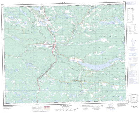
092P11 100 Mile House Canada topo map, 1:50,000 scale
092P11 100 Mile House NRCAN topographic map.
Includes UTM and GPS geographic coordinates (latitude and longitude). This 50k scale map is suitable for hiking, camping, and exploring, or you could frame it as a wall map.
Printed on-demand using high resolution, on heavy weight and acid free paper, or as an upgrade on a variety of synthetic materials.
Topos available on paper, Waterproof, Poly, or Tyvek. Usually shipping rolled, unless combined with other folded maps in one order.
- Product Number: NRCAN-092P11
- Parent Topo: TOPO-092P
- Map ID also known as: 092P11, 92P11
- Unfolded Size: Approximately 26" high by 36" wide
- Weight (paper map): ca. 55 grams
- Map Type: POD NRCAN Topographic Map
- Map Scale: 1:50,000
- Geographical region: British Columbia, Canada
Neighboring Maps:
All neighboring Canadian topo maps are available for sale online at 1:50,000 scale.
Purchase the smaller scale map covering this area: Topo-092P
Spatial coverage:
Topo map sheet 092P11 100 Mile House covers the following places:
- 100 Mile House - Interlakes - Canim Lake Indian Reserve 2 - Réserve indienne Canim Lake 2 - 101 Mile Lake - 103 Mile Lake - 105 Mile Lake - 108 Mile Lake - Abbs Lake - Abel Lake - Alans Lake - Big Lake - Buffalo Lake - Camel Lake - Carment Lakes - Chicken Lake - Chris Lake - Davis Lake - Davy Lake - Disputed Lakes - Earle Lake - Edmund Lake - Edwards Lake - Elliot Lake - Exeter Lake - Fiset Lake - Foxtail Lake - Guessagain Lake - Gwenie Lake - Hartwig Lake - Horse Lake - Irish Lake - Jack Frost Lake - Keith Lake - Kelsey Lake - Lily Pad Lake - Lilyleaf Lake - Longbow Lake - McKinlay Lake - Milch Lake - Milch Lakes - Mirage Lake - Mud Lake - Parting Lake - Parting Lakes - Quinn Lake - Roundup Lake - Savon Lake - Scout Lake - Sepa Lake - Simon Lake - Stephenson Lake - Straight Lake - Tad Lake - Tatton Lake - Trapping Lake - Valentine Lake - Watson Lake - Wildhorse Lake - Huckleberry Butte - Lone Butte - Cariboo Regional District - Fraser Plateau - Interior Plateau - Attwood Creek - Buffalo Creek - Chicken Creek - Eightyseven Creek - Evergreen Creek - Fawn Creek - Foxtail Creek - Halfway Creek - Little Bridge Creek - Longbow Creek - Ninetythree Mile Creek - Ravine Creek - Rock Creek - Simon Creek - Tatton Creek - Upper Willowdale Creek - Watch Creek - Watson Creek - 105 Mile House - 108 Mile House - 108 Mile Ranch - 87 Mile House - 93 Mile - Buffalo Creek - Canim - Eightyseven Mile House - Exeter - Fawn - Gateway - Lone Butte - Potter - Tatton - Willowford - Walker Valley


