
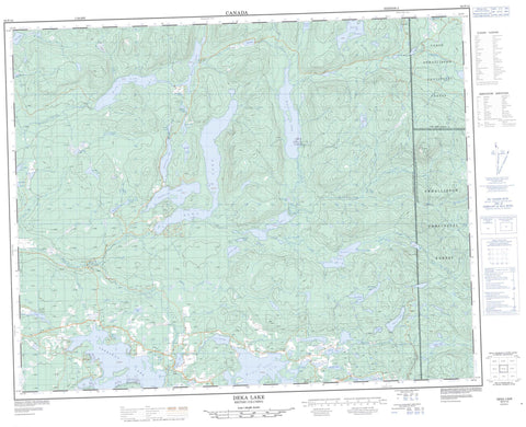
092P10 Deka Lake Canada topo map, 1:50,000 scale
092P10 Deka Lake NRCAN topographic map.
Includes UTM and GPS geographic coordinates (latitude and longitude). This 50k scale map is suitable for hiking, camping, and exploring, or you could frame it as a wall map.
Printed on-demand using high resolution, on heavy weight and acid free paper, or as an upgrade on a variety of synthetic materials.
Topos available on paper, Waterproof, Poly, or Tyvek. Usually shipping rolled, unless combined with other folded maps in one order.
- Product Number: NRCAN-092P10
- Parent Topo: TOPO-092P
- Map ID also known as: 092P10, 92P10
- Unfolded Size: Approximately 26" high by 36" wide
- Weight (paper map): ca. 55 grams
- Map Type: POD NRCAN Topographic Map
- Map Scale: 1:50,000
- Geographical region: British Columbia, Canada
Neighboring Maps:
All neighboring Canadian topo maps are available for sale online at 1:50,000 scale.
Purchase the smaller scale map covering this area: Topo-092P
Spatial coverage:
Topo map sheet 092P10 Deka Lake covers the following places:
- Interlakes - Long Island - Alans Lake - Apollo Lake - Balfour Lake - Bannerman Lake - Beartrap Lake - Boundary Line Lake - Bowers Lake - Bridge Lake - Carton Lake - Chris Lake - Cougar Lake - Deka Lake - Dockerill Lake - Dombey Lake - Donnely Lake - Dorrit Lake - Dragonfly Lake - Drewry Lake - Duckling Lake - East King Lake - Eastwood Lake - English Lake - Faulkner Lake - Fawn Lake - French Lake - Hathaway Lake - Hewton Lake - Higgins Lake - Lac des Roches - Lesser Fish Lake - Lonely Lake - Longbow Lake - Lorin Lake - Manning Lake - Marais Lake - Muddy Lake - Needa Lake - Otter Lake - Parks Lake - Peters Lake - Preacher Lake - Rat Lake - Reichmuth Lake - Roe Lake - Sheridan Lake - Stack Lake - Stack Lakes - Staley Lake - Sulphurous Lake - Sutherland Lake - Wavey Lake - West King Lake - Willow Lake - Wilson Lake - Windy Mountain - Cariboo Regional District - Fraser Plateau - Interior Plateau - Balfour Creek - Bridge Creek - Buffalo Creek - Canimred Creek - Deka Creek - Donald Creek - Dorrit Creek - Eastwood Creek - Fawn Creek - Hathaway Creek - Jim Creek - Judson Creek - Longbow Creek - Nesachi Creek - O'Neil Creek - Webb Creek - Windy Creek - Deka Lake - Roe Lake - Sheridan Lake


