
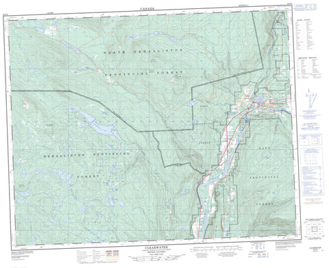
092P09 Clearwater Canada topo map, 1:50,000 scale
092P09 Clearwater NRCAN topographic map.
Includes UTM and GPS geographic coordinates (latitude and longitude). This 50k scale map is suitable for hiking, camping, and exploring, or you could frame it as a wall map.
Printed on-demand using high resolution, on heavy weight and acid free paper, or as an upgrade on a variety of synthetic materials.
Topos available on paper, Waterproof, Poly, or Tyvek. Usually shipping rolled, unless combined with other folded maps in one order.
- Product Number: NRCAN-092P09
- Parent Topo: TOPO-092P
- Map ID also known as: 092P09, 92P9, 92P09
- Unfolded Size: Approximately 26" high by 36" wide
- Weight (paper map): ca. 55 grams
- Map Type: POD NRCAN Topographic Map
- Map Scale: 1:50,000
- Geographical region: British Columbia, Canada
Neighboring Maps:
All neighboring Canadian topo maps are available for sale online at 1:50,000 scale.
Purchase the smaller scale map covering this area: Topo-092P
Spatial coverage:
Topo map sheet 092P09 Clearwater covers the following places:
- Hawser Point - Clearwater - Spahats Creek Falls - Axel Lake - Colborne Lake - Coldscaur Lake - Crater Lake - Deer Lake - Dutch Lake - Flapjack Lake - Friendly Lake - Grizzly Lakes - Hallamore Lake - Hardcastle Lake - Latremouille Lake - Laurel Lake - Lemieux Lake - Lolo Lake - Lost Horse Lake - Lost Lake - McCarthy Lake - Meadow Lake - Monticola Lake - Moose Lake - Moosehead Lake - Reflector Lake - Rioux Lake - Rock Island Lake - Russell Lake - Silver Lake - Star Lake - Steiger Lake - Surprise Lake - Ta Hoola Lake - Taweel Lake - Tintlhohtan Lake - Clearwater Peak - Grizzly Cub Mountain - Grizzly Mountain - Mount Heger - Pooytl Mountain - Queen Bess Ridge - Shuswap Highland - Skwilatin Mountain - Skwilkwakult Mountain - The Sentinels - Cariboo Regional District - Dutch Lake Park - North Thompson River Park - Spahats Creek Park - Taweel Park - Fraser Plateau - Interior Plateau - Mosquito Flats - Thompson Plateau - Axel Creek - Bester Creek - Brookfield Creek - Candle Creek - Canimred Creek - Clearwater River - Demers Creek - Eagle Creek - Fourteen Mile Creek - Gates Creek - Gill Creek - Hascheak Creek - Jenkins Creek - Jim Creek - Joseph Creek - Latremouille Creek - Lemieux Creek - Lolo Creek - Mann Creek - McCarthy Creek - Nehalliston Creek - North Thompson River - Rennie Creek - Rowley Creek - Russell Creek - Sands Creek - Spahats Creek - Wyllie Creek - Auldgirth - Black Pool - Blackpool - Clearwater Station - East Black Pool


