
092P08 Chu Chua Creek Canada topo map, 1:50,000 scale
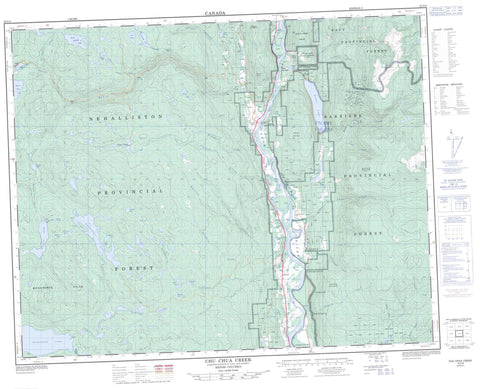
092P08 Chu Chua Creek NRCAN topographic map.
Includes UTM and GPS geographic coordinates (latitude and longitude). This 50k scale map is suitable for hiking, camping, and exploring, or you could frame it as a wall map.
Printed on-demand using high resolution, on heavy weight and acid free paper, or as an upgrade on a variety of synthetic materials.
Topos available on paper, Waterproof, Poly, or Tyvek. Usually shipping rolled, unless combined with other folded maps in one order.
- Product Number: NRCAN-092P08
- Parent Topo: TOPO-092P
- Map ID also known as: 092P08, 92P8, 92P08
- Unfolded Size: Approximately 26" high by 36" wide
- Weight (paper map): ca. 55 grams
- Map Type: POD NRCAN Topographic Map
- Map Scale: 1:50,000
- Geographical region: British Columbia, Canada
Neighboring Maps:
All neighboring Canadian topo maps are available for sale online at 1:50,000 scale.
Purchase the smaller scale map covering this area: Topo-092P
Spatial coverage:
Topo map sheet 092P08 Chu Chua Creek covers the following places:
- Boulder Creek Indian Reserve 5 - Nekalliston Indian Reserve 2 - North Thompson Indian Reserve 1 - Réserve indienne Boulder Creek 5 - Réserve indienne Nekalliston 2 - Réserve indienne North Thompson 1 - Akehurst Lake - Belcache Lake - Birch Lake - Bonaparte Lake - Caverhill Lake - Demers Lake - Dum Lake - Dunn Lake - Emar Lake - Emery Lake - Frog Lakes - Hallamore Lake - Janning Lake - Keith Lake - Latremouille Lake - Leonie Lake - Long Island Lake - Lupin Lakes - Lynn Lake - Malcolm Lake - McTaggart Lakes - Mulholland Lake - Nanak Lake - Nomans Lake - Patrick Lake - Phinetta Lake - Posby Lake - Powder Lake - Ramsay Lake - Salle Lake - Sanborn Lake - Smith Lake - Thuya Lakes - Tibbetts Lake - Baldy Mountain - Bonaparte Hills - Chinook Mountain - Chinook Mountains - Chu Chua Mountain - Fennell Mountains - Mount Fennell - Mount Loveway - Mount Olie - Queen Bess Ridge - Shuswap Highland - Cariboo Regional District - Chu Chua Cottonwood Park - Eakin Creek Canyon Park - Eakin Creek Floodplain Park - Emar Lakes Park - High Lakes Basin Park - North Thompson Islands Park - Fraser Plateau - Interior Plateau - Thompson Plateau - Axel Creek - Bonaparte River - Bottrel Creek - Bryan Creek - Caverhill Creek - Chinook Creek - Chu Chua Creek - Cowell Creek - Darling Creek - Darlington Creek - Delta Creek - Demers Creek - Dum Creek - Dunn Creek - Eagle Creek - Eakin Creek - Edwin Creek - Emar Creek - Ipsoot Creek - Joseph Creek - Kikwilli Creek - Latremouille Creek - Lemieux Creek - Leonie Creek - Lindquist Creek - Machete Creek - Macheté Creek - McTaggart Creek - Montigny Creek - Nanak Creek - Nehalliston Creek - Nelson Creek - Newhykulston Creek - North Thompson River - Phinetta Creek - Powder Creek - Skowootum Creek - Spokane Creek - Sprague Creek - Stolle Creek - Teather Creek - Thuya Creek - Willow Creek - Boulder - Chinook Cove - Chu Chua - Darfield - Little Fort - Mount Olie


