
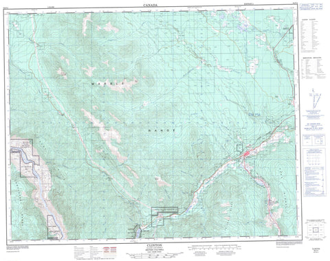
092P04 Clinton Canada topo map, 1:50,000 scale
092P04 Clinton NRCAN topographic map.
Includes UTM and GPS geographic coordinates (latitude and longitude). This 50k scale map is suitable for hiking, camping, and exploring, or you could frame it as a wall map.
Printed on-demand using high resolution, on heavy weight and acid free paper, or as an upgrade on a variety of synthetic materials.
Topos available on paper, Waterproof, Poly, or Tyvek. Usually shipping rolled, unless combined with other folded maps in one order.
- Product Number: NRCAN-092P04
- Parent Topo: TOPO-092P
- Map ID also known as: 092P04, 92P4, 92P04
- Unfolded Size: Approximately 26" high by 36" wide
- Weight (paper map): ca. 55 grams
- Map Type: POD NRCAN Topographic Map
- Map Scale: 1:50,000
- Geographical region: British Columbia, Canada
Neighboring Maps:
All neighboring Canadian topo maps are available for sale online at 1:50,000 scale.
Purchase the smaller scale map covering this area: Topo-092P
Spatial coverage:
Topo map sheet 092P04 Clinton covers the following places:
- Clinton Indian Reserve 1 - High Bar Indian Reserve 1 - High Bar Indian Reserve 1A - High Bar Indian Reserve 2 - Leon Creek Indian Reserve 2 - Leon Creek Indian Reserve 2A - Réserve indienne Clinton 1 - Réserve indienne High Bar 1 - Réserve indienne High Bar 1A - Réserve indienne High Bar 2 - Réserve indienne Leon Creek 2 - Réserve indienne Leon Creek 2A - 4 Mile Lake - 6 Mile Lake - Alkali Lakes - Barton Lake - Duck Lakes - Five Mile Lake - Kelly Lake - Kersey Lake - Leighwood Lake - Magnesia Lake - Salt Lake - Stick Lake - Three Mile Lake - Trurans Lake - Camelsfoot Range - Edge Hills - Hart Ridge - Lime Ridge - Mad Dog Mountain - Marble Mountains - Marble Range - Mount Bowman - Mount Kerr - Mount Soues - Pavilion Mountains - Pavilion Range - Soues Mountain - Tsilsalt Ridge - Wild Horse Ridge - Downing Park - Edge Hills Park - Kersey Lake Park - Marble Range Park - Fraser Plateau - Green Timber Plateau - Interior Plateau - Allen Creek - Barney Creek - Borrow Creek - Bowden Creek - Butcher Creek - Cavanagh Creek - Clinton Creek - Cutoff Valley Creek - Cutoffvalley Creek - Eleven Mile Creek - Fiftynine Creek - Fiftyone Creek - Fiftyseven Creek - Fortytwo Creek - Fraser River - Gabriel Creek - Goodrich Creek - Indian Creek - Juan Creek - Kay Creek - Kostering Creek - Lebasque Creek - Leon Creek - Minch Creek - Porcupine Creek - Soues Creek - Stable Creek - Two Mile Creek - Kelly Lake - Lime - Clinton


