
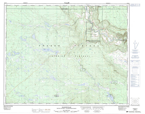
092O14 Hanceville Canada topo map, 1:50,000 scale
092O14 Hanceville NRCAN topographic map.
Includes UTM and GPS geographic coordinates (latitude and longitude). This 50k scale map is suitable for hiking, camping, and exploring, or you could frame it as a wall map.
Printed on-demand using high resolution, on heavy weight and acid free paper, or as an upgrade on a variety of synthetic materials.
Topos available on paper, Waterproof, Poly, or Tyvek. Usually shipping rolled, unless combined with other folded maps in one order.
- Product Number: NRCAN-092O14
- Parent Topo: TOPO-092O
- Map ID also known as: 092O14, 92O14
- Unfolded Size: Approximately 26" high by 36" wide
- Weight (paper map): ca. 55 grams
- Map Type: POD NRCAN Topographic Map
- Map Scale: 1:50,000
- Geographical region: British Columbia, Canada
Neighboring Maps:
All neighboring Canadian topo maps are available for sale online at 1:50,000 scale.
Purchase the smaller scale map covering this area: Topo-092O
Spatial coverage:
Topo map sheet 092O14 Hanceville covers the following places:
- Anahim's Flat Indian Reserve 1 - Brigham Creek Indian Reserve 3 - Réserve indienne Anahim's Flat 1 - Réserve indienne Brigham Creek 3 - Réserve indienne Saddle Horse 2 - Réserve indienne Stone 1 - Réserve indienne Stone 1A - Réserve indienne Stone 4 - Saddle Horse Indian Reserve 2 - Stone Indian Reserve 1 - Stone Indian Reserve 1A - Stone Indian Reserve 4 - Abrams Lake - Fletcher Lake - Gay Lake - Haines Lake - Hutch Lake - Kliyul Lake - Pamela Lake - Ragan Lake - Towydkin Lake - Tsuh Lake - Cariboo Regional District - Fraser Plateau - Interior Plateau - Old Bridge Rapids - Chilko River - Deer Creek - Haines Creek - McDermott Creek - Minton Creek - Schultz Creek - Zenzaco Creek - Hanceville - Hanceville - Lees Corner - Hanceville Canyon - Stoney Canyon


