
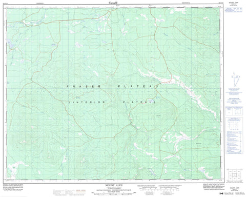
092O10 Mount Alex Canada topo map, 1:50,000 scale
092O10 Mount Alex NRCAN topographic map.
Includes UTM and GPS geographic coordinates (latitude and longitude). This 50k scale map is suitable for hiking, camping, and exploring, or you could frame it as a wall map.
Printed on-demand using high resolution, on heavy weight and acid free paper, or as an upgrade on a variety of synthetic materials.
Topos available on paper, Waterproof, Poly, or Tyvek. Usually shipping rolled, unless combined with other folded maps in one order.
- Product Number: NRCAN-092O10
- Parent Topo: TOPO-092O
- Map ID also known as: 092O10, 92O10
- Unfolded Size: Approximately 26" high by 36" wide
- Weight (paper map): ca. 55 grams
- Map Type: POD NRCAN Topographic Map
- Map Scale: 1:50,000
- Geographical region: British Columbia, Canada
Neighboring Maps:
All neighboring Canadian topo maps are available for sale online at 1:50,000 scale.
Purchase the smaller scale map covering this area: Topo-092O
Spatial coverage:
Topo map sheet 092O10 Mount Alex covers the following places:
- Alex Lake - Blackwater Lake - Cow Lake - Mons Lake - Snake Lake - Square Lake - Stobie Lake - Mount Alex - Cariboo Regional District - Fraser Plateau - Interior Plateau - Big Creek - Cooper Creek - Farwell Creek - Gaspard Creek - Little Gaspard Creek - McEwen Creek - Mons Creek - Tilton Creek - Twinflower Creek - Vedan Creek - Wales Creek - Word Creek - Williams Meadow


