
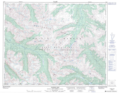
092O03 Warner Pass Canada topo map, 1:50,000 scale
092O03 Warner Pass NRCAN topographic map.
Includes UTM and GPS geographic coordinates (latitude and longitude). This 50k scale map is suitable for hiking, camping, and exploring, or you could frame it as a wall map.
Printed on-demand using high resolution, on heavy weight and acid free paper, or as an upgrade on a variety of synthetic materials.
Topos available on paper, Waterproof, Poly, or Tyvek. Usually shipping rolled, unless combined with other folded maps in one order.
- Product Number: NRCAN-092O03
- Parent Topo: TOPO-092O
- Map ID also known as: 092O03, 92O3, 92O03
- Unfolded Size: Approximately 26" high by 36" wide
- Weight (paper map): ca. 55 grams
- Map Type: POD NRCAN Topographic Map
- Map Scale: 1:50,000
- Geographical region: British Columbia, Canada
Neighboring Maps:
All neighboring Canadian topo maps are available for sale online at 1:50,000 scale.
Purchase the smaller scale map covering this area: Topo-092O
Spatial coverage:
Topo map sheet 092O03 Warner Pass covers the following places:
- Palisade Bluff - Warner Glacier - Hummingbird Lake - LizardLake - Lorna Lake - Marian Lake - Nadila Lake - Spruce Lake - Summit Lakes - Trigger Lake - Tyaughton Lake - Vic Lake - Warner Lake - Battlement Ridge - Chaîne Côtière - Chilcotin Ranges - Cluckata Ridge - Coast Mountains - Dash Hill - Denain Ridge - Denain Spur - Dickson Peak - Dickson Range - Dorrie Peak - Elbow Mountain - Feo Ridge - Feo Spur - Leckie Mountains - Mount Cunningham - Mount Davidson - Mount McClure - Mount Sheba - Mount Solomon - Mount Vic - Mount Warner - Pacific Ranges - Pearson Ridge - Porteau Mountain - Rae Ridge - Rae Spur - Red Hill - Salmon Mount - Sheba Mountain - Taseko Mountain - Trail Ridge - Warner Ridge - Wilson Ridge - Cariboo Regional District - Dil-Dil Plateau - Amazon Creek - B. & F. Creek - Battlement Creek - Beece Creek - Big Creek - Bonanza Creek - Cairnes Creek - Chita Creek - Crane Creek - Dash Creek - Denain Creek - Duane Creek - Eldorado Creek - Feo Creek - Granite Creek - Grant Creek - Graveyard Creek - Griswold Creek - Gun Creek - Honduras Creek - Last Creek - Leckie Creek - Lick Creek - Little Paradise Creek - Lizard Creek - Manson Creek - McClure Creek - Mud Creek - Nadila Creek - Nea Creek - Noaxe Creek - North Cinnabar Creek - Powell Creek - Rae Creek - Relay Creek - Rowbottom Creek - Roxey Creek - Slim Creek - Sluice Creek - Taseko River - Tosh Creek - Tyaughton Creek - Tyaughton River - Warner Creek - Elbow Pass - Iron Pass - Powell Pass - Tyoax Pass - Warner Pass


