
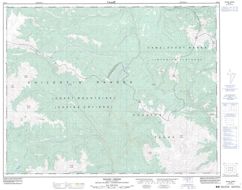
092O02 Noaxe Creek Canada topo map, 1:50,000 scale
092O02 Noaxe Creek NRCAN topographic map.
Includes UTM and GPS geographic coordinates (latitude and longitude). This 50k scale map is suitable for hiking, camping, and exploring, or you could frame it as a wall map.
Printed on-demand using high resolution, on heavy weight and acid free paper, or as an upgrade on a variety of synthetic materials.
Topos available on paper, Waterproof, Poly, or Tyvek. Usually shipping rolled, unless combined with other folded maps in one order.
- Product Number: NRCAN-092O02
- Parent Topo: TOPO-092O
- Map ID also known as: 092O02, 92O2, 92O02
- Unfolded Size: Approximately 26" high by 36" wide
- Weight (paper map): ca. 55 grams
- Map Type: POD NRCAN Topographic Map
- Map Scale: 1:50,000
- Geographical region: British Columbia, Canada
Neighboring Maps:
All neighboring Canadian topo maps are available for sale online at 1:50,000 scale.
Purchase the smaller scale map covering this area: Topo-092O
Spatial coverage:
Topo map sheet 092O02 Noaxe Creek covers the following places:
- Lillooet Land District - Grizzly Bear Lake - Horse Lake - Mud Lakes - Noaxe Lake - Prentice Lake - Roaster Lake - Spruce Lake - Swartz (Fish) Lake - Tyaughton Lake - Big Dog Mountain - Big Sheep Mountain - Buck Mountain - Camelsfoot Mountains - Camelsfoot Range - Cardtable Mountain - Castle Mountain - Castle Peak - Chaîne Côtière - Chilcotin Ranges - Coast Mountains - Dickson Peak - Dickson Range - Eldorado Mountain - Fortress Ridge - French Mountain - Leckie Mountains - Nine Mile Ridge - Pacific Ranges - Pearson Ridge - Poison Mountain - Quartz Mountain - Red Mountain - Relay Mountain - Shulaps Mountain - Shulaps Range - Tepee Mountain - Cariboo Regional District - Fraser Plateau - Interior Plateau - B. & F. Creek - Blue Creek - Bon Creek - Bonanza Creek - Churn Creek - Crane Creek - Dash Creek - Davey Jones Creek - Eldorado Creek - Evelyn Creek - Leckie Creek - Lick Creek - Lindsey Creek - Little Paradise Creek - Liza Creek - Lone Cabin Creek - Lone Valley Creek - Mud Creek - Nea Creek - Nicodemas Creek - Noaxe Creek - North Cinnabar Creek - Old Friend Creek - Panlos Creek - Paradise Creek - Poisonmount Creek - Reid Creek - Relay Creek - Rook Creek - Roxey Creek - Russel Creek - Slim Creek - Spruce Lake Creek - Taylor Creek - Tyaughton Creek - Tyaughton River - Yalakom River - Castle Pass


