
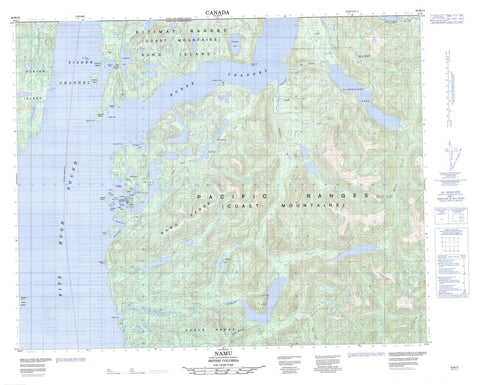
092M13 Namu Canada topo map, 1:50,000 scale
092M13 Namu NRCAN topographic map.
Includes UTM and GPS geographic coordinates (latitude and longitude). This 50k scale map is suitable for hiking, camping, and exploring, or you could frame it as a wall map.
Printed on-demand using high resolution, on heavy weight and acid free paper, or as an upgrade on a variety of synthetic materials.
Topos available on paper, Waterproof, Poly, or Tyvek. Usually shipping rolled, unless combined with other folded maps in one order.
- Product Number: NRCAN-092M13
- Parent Topo: TOPO-092M
- Map ID also known as: 092M13, 92M13
- Unfolded Size: Approximately 26" high by 36" wide
- Weight (paper map): ca. 55 grams
- Map Type: POD NRCAN Topographic Map
- Map Scale: 1:50,000
- Geographical region: British Columbia, Canada
Neighboring Maps:
All neighboring Canadian topo maps are available for sale online at 1:50,000 scale.
Purchase the smaller scale map covering this area: Topo-092M
Spatial coverage:
Topo map sheet 092M13 Namu covers the following places:
- Fougner Bay - Harlequin Basin - Kisameet Bay - Kiwash Cove - Namu Harbour - Rock Inlet - Warrior Cove - Whirlwind Bay - Windsor Cove - Campbell Point - De Cosmos Point - DeCosmos Point - Edmund Point - Haaksvold Point - Hvidsten Point - Koeye Point - Middleton Point - Ontario Point - Uganda Point - Walker Point - Burke Channel - Cloverleaf Passage - Fisher Channel - Fitz Hugh Sound - Morehouse Passage - North Passage - Kisameet Indian Reserve 7 - Réserve indienne Kisameet 7 - Calvert Island - Clam Island - Cliff Island - Humchitt Island - Hunter Island - King Island - Kipling Island - Kisameet Islands - Kiwash Island - Lapwing Island - Nalau Island - Sagen Islet - Sunday Island - Verdant Island - Cranberry Lake - De Cosmos Lagoon - DeCosmos Lagoon - Draney Lakes - Gildersleve Lake - Kisameet Lake - Koeye Lake - Little Koeye Lake - Namu Lake - Osborne Lake - Chaîne Côtière - Coast Mountains - Kitimat Ranges - Koeye Range - Namu Range - Pacific Ranges - Central Coast Regional District - Hakai Conservation Study Area - Hakai Recreation Area - Amy Creek - Cold Creek - Doc Creek - Doris Creek - Koeye River - MacNair Creek - Namu River - Nootum River - Quatlena River - Third Creek - West Inrig Creek - Fog Rocks - Loo Rock - Que Que Rock - Que Que Rocks - Namu


