
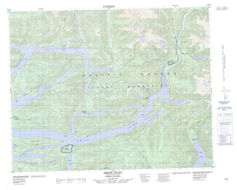
092M06 Smith Inlet Canada topo map, 1:50,000 scale
092M06 Smith Inlet NRCAN topographic map.
Includes UTM and GPS geographic coordinates (latitude and longitude). This 50k scale map is suitable for hiking, camping, and exploring, or you could frame it as a wall map.
Printed on-demand using high resolution, on heavy weight and acid free paper, or as an upgrade on a variety of synthetic materials.
Topos available on paper, Waterproof, Poly, or Tyvek. Usually shipping rolled, unless combined with other folded maps in one order.
- Product Number: NRCAN-092M06
- Parent Topo: TOPO-092M
- Map ID also known as: 092M06, 92M6, 92M06
- Unfolded Size: Approximately 26" high by 36" wide
- Weight (paper map): ca. 55 grams
- Map Type: POD NRCAN Topographic Map
- Map Scale: 1:50,000
- Geographical region: British Columbia, Canada
Neighboring Maps:
All neighboring Canadian topo maps are available for sale online at 1:50,000 scale.
Purchase the smaller scale map covering this area: Topo-092M
Spatial coverage:
Topo map sheet 092M06 Smith Inlet covers the following places:
- Allard Bay - Anchor Cove - Boswell Inlet - Burnt Island Harbour - Draney Inlet - East Arm Smith Inlet - Hickey Cove - Margaret Bay - Naysash Bay - Naysash Inlet - Quascilla Bay - Robert Arm - Security Bay - Security Cove - Smith Inlet - Walkum Bay - Adelaide Point - Cape Anne - Ahclakerho Channel - Halowis Indian Reserve 5 - Nekite Indian Reserve 2 - Réserve indienne Halowis 5 - Réserve indienne Nekite 2 - Réserve indienne Tseetsum-Sawlasilah 6 - Réserve indienne Wyclese 1 - Tseetsum-Sawlasilah Indian Reserve 6 - Wyclese Indian Reserve 1 - Ahclakerho Islands - Burnt Island - Greaves Island - Jap Island - Twain Islands - Allard Lake - Anna Lake - Annabelle Lake - Boomer Lake - Caroline Lake - Gordon Lake - Gordon Lakes - Jean Lake - Long Lake - Piper Lake - Triangle Lake - Trout Lake - Wyclees Lagoon - Chaîne Côtière - Coast Mountains - Pacific Ranges - Central Coast Regional District - Regional District of Mount Waddington - Allard Creek - Barer Creek - Boulder Creek - Canoe Creek - Draney Creek - Johnston Creek - Lockhart Gordon Creek - Lockhartgordon Creek - Margaret Creek - Naysash Creek - Nekite River - Piper River - Smokehouse Creek - Walkum Creek - Broad Reach - Margaret Bay - Nalos Landing


