
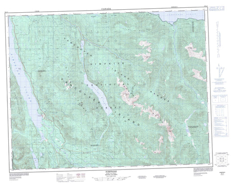
092L07 Nimpkish Canada topo map, 1:50,000 scale
092L07 Nimpkish NRCAN topographic map.
Includes UTM and GPS geographic coordinates (latitude and longitude). This 50k scale map is suitable for hiking, camping, and exploring, or you could frame it as a wall map.
Printed on-demand using high resolution, on heavy weight and acid free paper, or as an upgrade on a variety of synthetic materials.
Topos available on paper, Waterproof, Poly, or Tyvek. Usually shipping rolled, unless combined with other folded maps in one order.
- Product Number: NRCAN-092L07
- Parent Topo: TOPO-092L
- Map ID also known as: 092L07, 92L7, 92L07
- Unfolded Size: Approximately 26" high by 36" wide
- Weight (paper map): ca. 55 grams
- Map Type: POD NRCAN Topographic Map
- Map Scale: 1:50,000
- Geographical region: British Columbia, Canada
Neighboring Maps:
All neighboring Canadian topo maps are available for sale online at 1:50,000 scale.
Purchase the smaller scale map covering this area: Topo-092L
Spatial coverage:
Topo map sheet 092L07 Nimpkish covers the following places:
- Robson Bight - Broughton Strait - Johnstone Strait - Halfway Islands - Anutz Lake - Bonanza Lake - Claud Elliott Lake - Diane Lake - Fickle Lake - Huson Lake - Hustan Lake - Ida Lake - Mudge Lake - Nimpkish Lake - Steele Lake - Sua Lake - Tsitika Lake - Warm Lake - Bonanza Range - Franklin Range - Hankin Range - Karmutsen Range - Karmutzen Range - Mount Ashwood - Mount Collinson - Mount Derby - Mount Hoy - Mount Kinman - Mount Sir John - Tsitika Mountain - Vancouver Island Mountains - Vancouver Island Ranges - Whiltilla Mountain - Regional District of Comox-Strathcona - Regional District of Mount Waddington - Claud Elliott Lake Park - Lower Tsitika River Park - Nimpkish Lake Park - Robson Bight (Michael Bigg) Park - Adriana Creek - Atluck Creek - Bonanza River - Catherine Creek - Claud Elliott Creek - Kaikash Creek - Kaipit Creek - Kilpala River - Kinman Creek - Kokish River - Lukwa Creek - Mukwilla Creek - Nimpkish River - Noomas Creek - Robson Creek - Schmidt Creek - Sir John Creek - Steele Creek - Storey Creek - Sua Creek - Teisum Creek - Tlakwa Creek - Tsiko Creek - Tsitika River - Tsitkwa River - Tsulton River - Woodengl Creek - Woodengle Creek - Nimpkish - Nimpkish Camp


