
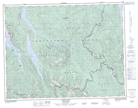
092L06 Alice Lake Canada topo map, 1:50,000 scale
092L06 Alice Lake NRCAN topographic map.
Includes UTM and GPS geographic coordinates (latitude and longitude). This 50k scale map is suitable for hiking, camping, and exploring, or you could frame it as a wall map.
Printed on-demand using high resolution, on heavy weight and acid free paper, or as an upgrade on a variety of synthetic materials.
Topos available on paper, Waterproof, Poly, or Tyvek. Usually shipping rolled, unless combined with other folded maps in one order.
- Product Number: NRCAN-092L06
- Parent Topo: TOPO-092L
- Map ID also known as: 092L06, 92L6, 92L06
- Unfolded Size: Approximately 26" high by 36" wide
- Weight (paper map): ca. 55 grams
- Map Type: POD NRCAN Topographic Map
- Map Scale: 1:50,000
- Geographical region: British Columbia, Canada
Neighboring Maps:
All neighboring Canadian topo maps are available for sale online at 1:50,000 scale.
Purchase the smaller scale map covering this area: Topo-092L
Spatial coverage:
Topo map sheet 092L06 Alice Lake covers the following places:
- Neroutsos Inlet - Thurburn Bay - Ker Point - Rupert Land District - Cayilth Indian Reserve 5 - Cayuse Indian Reserve 6 - Réserve indienne Cayilth 5 - Réserve indienne Cayuse 6 - Réserve indienne Teeta 7 - Teeta Indian Reserve 7 - Frigon Islets - Ketchen Island - Alice Lake - Angler Lake - Benson Lake - Cross Lake - Iron Lake - Kathleen Lake - Keogh Lake - Lac Truite - Maynard Lake - Newt Lake - Nimpkish Lake - Tahsish Lake - Three Isle Lake - Victoria Lake - Castle Mountain - Karmutsen Range - Karmutzen Mountain - Karmutzen Range - Merry Widow Mountain - Tlakwa Mountain - Vancouver Island Mountains - Vancouver Island Ranges - Regional District of Mount Waddington - Benson River - Blue Ox Creek - Cayeghle Creek - Cayuse Creek - Cluxewe River - Colonial Creek - Craft Creek - Howlal Creek - Jakonaal Creek - Jeune Creek - Karmutsen Creek - Karmutzen Creek - Kashutl River - Kauwinch River - Kauwinch River - Keogh River - Kilpala River - Kwois Creek - Lippy Creek - Malook Creek - Marble River - Merry Widow Creek - Neeta Creek - Nequiltpaalis Creek - Ououkinsh River - Oyeyelinne Creek - Pinch Creek - Raging River - Rainier Creek - Sorenson Creek - Tahsish River - Teihsum River - Three Lakes Creek - Tlakwa Creek - Utluh Creek - Wady Creek - Waukwaas Creek - Yoo Took Creek - Yootook Creek - Mist Rock - Muir Rocks - Benson Lake - Jeune Landing - Rumble Beach - Port Alice


