
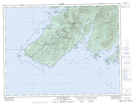
092L04 Brooks Peninsula Canada topo map, 1:50,000 scale
092L04 Brooks Peninsula NRCAN topographic map.
Includes UTM and GPS geographic coordinates (latitude and longitude). This 50k scale map is suitable for hiking, camping, and exploring, or you could frame it as a wall map.
Printed on-demand using high resolution, on heavy weight and acid free paper, or as an upgrade on a variety of synthetic materials.
Topos available on paper, Waterproof, Poly, or Tyvek. Usually shipping rolled, unless combined with other folded maps in one order.
- Product Number: NRCAN-092L04
- Parent Topo: TOPO-092L
- Map ID also known as: 092L04, 92L4, 92L04
- Unfolded Size: Approximately 26" high by 36" wide
- Weight (paper map): ca. 55 grams
- Map Type: POD NRCAN Topographic Map
- Map Scale: 1:50,000
- Geographical region: British Columbia, Canada
Neighboring Maps:
All neighboring Canadian topo maps are available for sale online at 1:50,000 scale.
Purchase the smaller scale map covering this area: Topo-092L
Spatial coverage:
Topo map sheet 092L04 Brooks Peninsula covers the following places:
- Ambrosia Bay - Aster Bay - Battle Bay - Brooks Bay - Checleset Bay - Columbia Cove - Drift Whale Bay - Guilliams Bay - Hackett Bay - Klaskish Anchorage - Klaskish Inlet - Nasparti Inlet - Acous Peninsula - Brooks Peninsula - Cape Cook - Cautious Point - Clerke Point - Green Head - Izard Point - Jackobson Point - Lorenz Point - Mahope Point - Orchard Point - Pinnacle Point - Sapir Point - Theodore Point - Gay Passage - Acous Indian Reserve 1 - Checkaklis Island Indian Reserve 9 - Hub-toul Indian Reserve 2A - Klaskish Indian Reserve 3 - Mahope Indian Reserve 3 - Quin-e-ex Indian Reserve 8 - Réserve indienne Acous 1 - Réserve indienne Checkaklis Island 9 - Réserve indienne Hub-toul 2A - Réserve indienne Klaskish 3 - Réserve indienne Mahope 3 - Réserve indienne Quin-e-ex 8 - Réserve indienne Upsowis 6 - Upsowis Indian Reserve 6 - Barrier Islands - Bonner Islet - Bunsby Islands - Checkaklis Island - Clara Islet - Clerke Islet - Crabapple Islets - Cuttle Islets - Donald Islets - Guilliams Island - Hackett Island - Hat Island - McDougal Island - O'Leary Islets - Scarf Island - Shelter Island - Skirmish Islets - Solander Island - The Haystacks - Vancouver Island - Yule Island - Andromeda Lake - Canoe Lake - Cape Cook Lagoon - Cassiope Pond - Cladothamnus Lake - Drosera Lake - Empetrum Lake - Gaultheria Lake - Gentiana Lake - Johnson Lagoon - Kalmia Lake - Ledum Lake - Loiseleuria Lake - Menziesia Lake - Moneses Lake - Oxycoccus Lake - Phyllodoce Lake - Pyrola Lake - Vaccinium Lake - Button Peak - Byers Cone - Doom Mountain - Harris Peak - Lagoon Peak - Mount Seaton - Nunatak Mountain - Ragged Cone - Refugium Range - Saxifraga Mountain - Shields Cone - Vancouver Island Mountains - Vancouver Island Ranges - Regional District of Comox-Strathcona - Regional District of Mount Waddington - Big Bunsby Marine Park - Big Bunsby Park - Brooks Peninsula Park - Brooks Peninsula Recreation Area - Amos Creek - Amos River - Canoe Creek - Cladothamnus Creek - East Creek - Gold Creek - Harris Creek - Kalmia Creek - Kingfisher Creek - Marks Creek - Menziesia Creek - Nordstrom Creek - Romanzoffia Creek - Scramble Creek - Baker Rock - Banks Reef - Boit Rock - Clerke Reefs - Cutler Rock - East Rock - Eldridge Rock - Fairway Rock - Ferey Rock - Longback Rocks - McKiel Rock - Mile Rock - Quineex Reef - Sulivan Reefs - Yule Rock


