
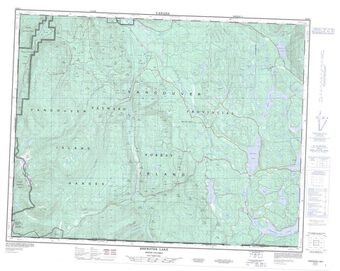
092K04 Brewster Lake Canada topo map, 1:50,000 scale
092K04 Brewster Lake NRCAN topographic map.
Includes UTM and GPS geographic coordinates (latitude and longitude). This 50k scale map is suitable for hiking, camping, and exploring, or you could frame it as a wall map.
Printed on-demand using high resolution, on heavy weight and acid free paper, or as an upgrade on a variety of synthetic materials.
Topos available on paper, Waterproof, Poly, or Tyvek. Usually shipping rolled, unless combined with other folded maps in one order.
- Product Number: NRCAN-092K04
- Parent Topo: TOPO-092K
- Map ID also known as: 092K04, 92K4, 92K04
- Unfolded Size: Approximately 26" high by 36" wide
- Weight (paper map): ca. 55 grams
- Map Type: POD NRCAN Topographic Map
- Map Scale: 1:50,000
- Geographical region: British Columbia, Canada
Neighboring Maps:
All neighboring Canadian topo maps are available for sale online at 1:50,000 scale.
Purchase the smaller scale map covering this area: Topo-092K
Spatial coverage:
Topo map sheet 092K04 Brewster Lake covers the following places:
- Sayward Land District - Île de Vancouver - Vancouver Island - Amor Lake - Bear Lake - Beaver Lake - Blackwater Lake - Bodil Lake - Boot Lake - Bootfrog Lake - Brewster Lake - Camp Lake - Campbell Lake - Cecil Lake - Cedar Lake - Chain Lake - Chetwood Lake - Comida Lake - Cooper Lake - Crescent Lake - Deer Lake - Duck Lake - Farewell Lake - First Lake - Frog Lake - Fry Lake - Garrett Lake - George's Lake - Gosling Lake - Grace Lake - Gray Lake - Hayes Lake - Higgens Lake - Higgins Lake - Ingeborg Lake - Jessie Lake - Kathleen Lake - Lawier Lake - Lawson Lake - Little Mud Lake - Marilou Lake - Martha Lake - McDougal Lake - McNair Lake - Merrill Lake - Mohun Lake - Mud Lake - Muskeg Lake - Paterson Lake - Pinter Lake - Roberts Lake - Seal Lake - Second Lake - Spirit Lake - Stewart Lake - Surprise Lake - Swamp Lake - Third Lake - Twin Lake - Welcome Lake - Whymper Lake - Vancouver Island Mountains - Vancouver Island Ranges - Regional District of Comox-Strathcona - Strathcona Park - Amor de Cosmos Creek - Amor De Cosmos Creek - Bear Creek - Bigtree Creek - Campbell River - Cooper Creek - Crowned Creek - Greenstone Creek - Grilse Creek - Kay Creek - Little Memekay River - Marilou Creek - Memekay River - Middle Memekay River - North Memekay River - Roberts Creek - Rock Creek - Salmon River - West Salmon River - White River


