
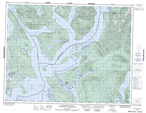
092K02 Desolation Sound Canada topo map, 1:50,000 scale
092K02 Desolation Sound NRCAN topographic map.
Includes UTM and GPS geographic coordinates (latitude and longitude). This 50k scale map is suitable for hiking, camping, and exploring, or you could frame it as a wall map.
Printed on-demand using high resolution, on heavy weight and acid free paper, or as an upgrade on a variety of synthetic materials.
Topos available on paper, Waterproof, Poly, or Tyvek. Usually shipping rolled, unless combined with other folded maps in one order.
- Product Number: NRCAN-092K02
- Parent Topo: TOPO-092K
- Map ID also known as: 092K02, 92K2, 92K02
- Unfolded Size: Approximately 26" high by 36" wide
- Weight (paper map): ca. 55 grams
- Map Type: POD NRCAN Topographic Map
- Map Scale: 1:50,000
- Geographical region: British Columbia, Canada
Neighboring Maps:
All neighboring Canadian topo maps are available for sale online at 1:50,000 scale.
Purchase the smaller scale map covering this area: Topo-092K
Spatial coverage:
Topo map sheet 092K02 Desolation Sound covers the following places:
- Blind Creek - Call Bight - Carrington Bay - Chippewa Bay - Cortes Bay - Desolation Sound - Doctor Bay - Echo Bay - Eveleigh Anchorage - Forbes Bay - Galley Bay - Gorge Harbour - Grace Harbour - Isabel Bay - Lancelot Inlet - Laura Cove - Malaspina Inlet - Manson Bay - Melanie Cove - Okeover Arm - Okeover Inlet - Parker Harbour - Pendrell Sound - Penrose Bay - Portage Cove - Prideaux Haven - Quartz Bay - Refuge Cove - Roscoe Bay - Salubrious Bay - Smelt Bay - Squirrel Cove - Talbot Cove - Teakerne Arm - Tenedos Bay - Theodosia Inlet - Thors Cove - Tiber Bay - Trevenen Bay - Turner Bay - Von Donop Inlet - Wootton Bay - Bastion Point - Bishop Point - Bohn Point - Bold Head - Booker Point - Boulder Point - Bunster Point - Church Point - Coode Peninsula - Copplestone Point - Durham Point - Ellen Point - Ellen Point - Galahad Point - Gifford Peninsula - Grail Point - Hare Point - Hillingdon Point - Hope Point - Horace Head - Horace Point - Iron Point - Joyce Point - Junction Point - Kakaekae Point - Lloyd Point - Lucy Point - Malaspina Peninsula - Mary Point - Marylebone Point - Melanie Point - Moss Point - Myrmidon Point - Price Point - Sarah Point - Scott Point - Selina Point - Shirley Point - Spilsbury Point - Stop Point - Stopford Point - Sutil Point - Tongue Point - Walter Point - Zephine Head - Baker Passage - Homfray Channel - Lewis Channel - Strait of Georgia - Sutil Channel - Thulin Passage - Waddington Channel - Ahpokum Indian Reserve 9 - Kahkaykay Indian Reserve 6 - Paukeanum Indian Reserve 3 - Quequa Indian Reserve 6 - Réserve indienne Ahpokum 9 - Réserve indienne Kahkaykay 6 - Réserve indienne Paukeanum 3 - Réserve indienne Quequa 6 - Réserve indienne Squirrel Cove 8 - Réserve indienne Toquana 4 - Réserve indienne Tork 7 - Réserve indienne Tsun Tine Ah 37 - Squirrel Cove Indian Reserve 8 - Toquana Indian Reserve 4 - Tork Indian Reserve 7 - Allies Island - Beulah Island - Broken Island - Cochrane Islands - Coode Island - Copeland Islands - Copplestone Island - Cortes Island - Cross Islet - Curme Islands - Deadman Island - Double Islands - East Redonda Island - Edith Island - Elworthy Island - Eveleigh Island - Goat Island - Grass Islet - Hernando Island - Isbister Islands - Jean Island - Josephine Islands - Kinghorn Island - Little Island - Lucy Islet - Madge Island - Martin Island - Martin Islands - Mary Islands - Melville Island - Mink Island - Morgan Island - Neck Islet - Neville Islet - Otter Island - Paige Islets - Pill Islets - Polly Island - Powell Islands - Powell Islets - Protection Island - Redonda Islands - Repulse Island - Ring Island - Roffey Island - Scobell Island - Station Island - Susan Islets - Talbot Islet - Thorp Island - Three Islets - Thynne Island - Tory Islands - Townley Islands - Twin Islands - Ulloa Islands - West Redonda Island - William Islands - Anvil Lake - Baile Lake - Black Lake - Carrington Lagoon - Cassel Lake - Cloud Lake - Cork Lake - Ellis Lake - Gunflint Lake - Hague Lake - Hinder Lake - Isle Lake - Olsen Lake - Powell Lake - Refuge Lagoon - Robertson Lake - Thompson Lake - Unwin Lake - Wiley Lake - Bunster Hills - Bunster Range - Chaîne Côtière - Cliff Peak - Coast Mountains - Dudley Cone - Green Mountain - Llanover Mountain - Mount Addenbroke - Mount Crawshay - Mount Pardoe - Mount Spooner - Mount Weaver - Nipple Summit - Pacific Ranges - Unwin Range - Powell River Regional District - Regional District of Comox-Strathcona - Copeland Islands Marine Park - Desolation Sound Marine Park - Desolation Sound Marine Recreation Area - Háthayim Marine Park - Háthayim Park - Malaspina Park - Mansons Landing Marine Park - Mansons Landing Marine Recreation Area - Mansons Landing Park - Mansons Landing Recreation Area - Roscoe Bay Park - Smelt Bay Park - Teakerne Arm Park - Von Donop Marine Park - Appleton Creek - Bryden Creek - Ellis Creek - Forbes Creek - Hinder Creek - Lloyd Creek - Olsen Creek - Theodosia River - Boundary Rock - Cavendish Rock - Central Rock - Kinghorn Rocks - Lion Rock - Little Rock - Oriel Rock - Oriel Rocks - Pringle Rock - Ray Rock - Rosetta Rock - Sky Pilot Rock - Stacey Rock - Bliss Landing - Cortes Bay - Foch - Mansons Landing - Refuge Cove - Seaford - Squirrel Cove - Teakerne Arm - Theodosia Arm


