
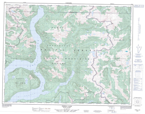
092K01 Powell Lake Canada topo map, 1:50,000 scale
092K01 Powell Lake NRCAN topographic map.
Includes UTM and GPS geographic coordinates (latitude and longitude). This 50k scale map is suitable for hiking, camping, and exploring, or you could frame it as a wall map.
Printed on-demand using high resolution, on heavy weight and acid free paper, or as an upgrade on a variety of synthetic materials.
Topos available on paper, Waterproof, Poly, or Tyvek. Usually shipping rolled, unless combined with other folded maps in one order.
- Product Number: NRCAN-092K01
- Parent Topo: TOPO-092K
- Map ID also known as: 092K01, 92K1, 92K01
- Unfolded Size: Approximately 26" high by 36" wide
- Weight (paper map): ca. 55 grams
- Map Type: POD NRCAN Topographic Map
- Map Scale: 1:50,000
- Geographical region: British Columbia, Canada
Neighboring Maps:
All neighboring Canadian topo maps are available for sale online at 1:50,000 scale.
Purchase the smaller scale map covering this area: Topo-092K
Spatial coverage:
Topo map sheet 092K01 Powell Lake covers the following places:
- Goat Island - Alpine Lake - Arctic Lake - Barkshack Lake - Big Crater Lake - Boulder Lake - Centre Lake - Clover Lake - Cup Lake - Freda Lake - Frog Pond Lake - Frogpond Lake - Goat Lake - High Falls Lake - Ice Lake - Little Crater Lake - Powell Lake - Scrub Lake - Skwim Lake - Spire Lake - Windsor Lake - Beartooth Mountain - Chaîne Côtière - Coast Mountains - Goat Mountain - Mount Alfred - Mount Alice - Mount Cambridge - Overlook Mountain - Pacific Ranges - Skwim Mountain - The Hump - Toms Thumb - Unwin Range - Powell River Regional District - Alfred Creek - Barkshack Creek - Beartooth Creek - Bradburn Creek - Brittain River - Eldred River - Jim Brown Creek - Lausmann Creek - McMillan Creek - Olsen Creek - Powell River - Skwawka River - Slane Creek


