
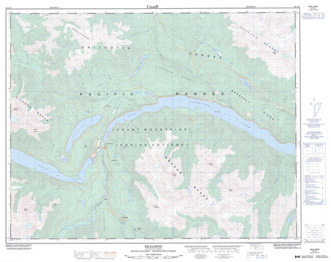
092J15 Bralorne Canada topo map, 1:50,000 scale
092J15 Bralorne NRCAN topographic map.
Includes UTM and GPS geographic coordinates (latitude and longitude). This 50k scale map is suitable for hiking, camping, and exploring, or you could frame it as a wall map.
Printed on-demand using high resolution, on heavy weight and acid free paper, or as an upgrade on a variety of synthetic materials.
Topos available on paper, Waterproof, Poly, or Tyvek. Usually shipping rolled, unless combined with other folded maps in one order.
- Product Number: NRCAN-092J15
- Parent Topo: TOPO-092J
- Map ID also known as: 092J15, 92J15
- Unfolded Size: Approximately 26" high by 36" wide
- Weight (paper map): ca. 55 grams
- Map Type: POD NRCAN Topographic Map
- Map Scale: 1:50,000
- Geographical region: British Columbia, Canada
Neighboring Maps:
All neighboring Canadian topo maps are available for sale online at 1:50,000 scale.
Purchase the smaller scale map covering this area: Topo-092J
Spatial coverage:
Topo map sheet 092J15 Bralorne covers the following places:
- Lajoie Dam - Terzaghi Dam - Bobb Lake - Carpenter Lake - Downton Lake - Downton Reservoir - Gun Lake - Gwyneth Lake - Keary Lake - Kingdom Lake - Lajoie Lake - Liza Lake - Marshall Lake - McDonald Lake - Mead Lake - Mowson Pond - Noel Lake - Pearson Pond - Pearson Ponds - Plateau Ponds - Spruce Lake - Sucker Lake - Tyaughton Lake - Bendor Range - Castle Peak - Chaîne Côtière - Chilcotin Ranges - Coast Mountains - Dickson Peak - Dickson Range - Eldorado Mountain - Green Mountain - Harris Ridge - Leckie Mountains - Marshall Ridge - Mount Bobb - Mount Fergusson - Mount Penrose - Mount Sloan - Mount Truax - Mount Williams - Mount Zola - Pacific Ranges - Pearson Ridge - Royal Peak - Shulaps Mountain - Shulaps Peak - Shulaps Range - Gun Lake Park - Aggie Creek - Alder Brook - Ault Creek - B. & F. Creek - Blackbird Creek - Bobb Creek - Bonanza Creek - Brett Creek - Cadwallader Creek - Carl Creek - Collis Creek - Copp Creek - Crane Creek - Crazy Creek - Cromer Creek - East Liza Creek - Eldorado Creek - Extension Creek - Fergusson Creek - Freiberg Creek - Girl Creek - Gun Creek - Gwyneth Creek - Hawthorn Creek - Hog Creek - Howe Creek - Hurley River - Jewel Creek - Jim Creek - Lajoie Creek - Leckie Creek - Lick Creek - Lindsey Creek - Liza Creek - Marshall Creek - Mason Creek - McDonald Creek - McKinley Creek - Mud Creek - Nea Creek - Noaxe Creek - Noel Creek - Nomad Creek - North Cinnabar Creek - Pearson Creek - Penrose Creek - Peridotite Creek - Piebiter Creek - Plutus Creek - President Creek - Relay Creek - Roxey Creek - Slim Creek - Spruce Lake Creek - Standard Creek - Steep Creek - Sumner Creek - Taylor Creek - Tommy Creek - Truax Creek - Twinturn Creek - Tyaughton Creek - Tyaughton River - Walk Creek - Walker Creek - Williams Creek - Bralorne - Brexton - Fish Lake - Gold Bridge - Haylmore - Ogden - Pioneer Mine - Camel Pass


