
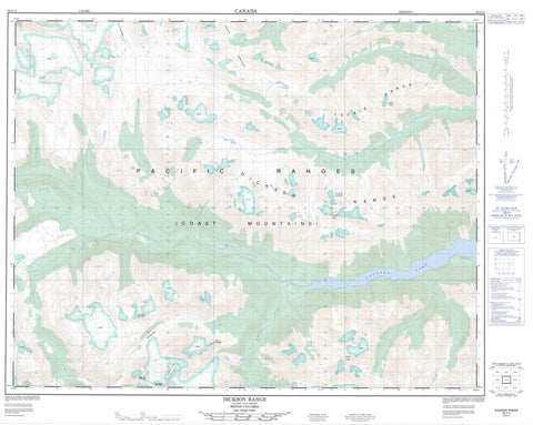
092J14 Dickson Range Canada topo map, 1:50,000 scale
092J14 Dickson Range NRCAN topographic map.
Includes UTM and GPS geographic coordinates (latitude and longitude). This 50k scale map is suitable for hiking, camping, and exploring, or you could frame it as a wall map.
Printed on-demand using high resolution, on heavy weight and acid free paper, or as an upgrade on a variety of synthetic materials.
Topos available on paper, Waterproof, Poly, or Tyvek. Usually shipping rolled, unless combined with other folded maps in one order.
- Product Number: NRCAN-092J14
- Parent Topo: TOPO-092J
- Map ID also known as: 092J14, 92J14
- Unfolded Size: Approximately 26" high by 36" wide
- Weight (paper map): ca. 55 grams
- Map Type: POD NRCAN Topographic Map
- Map Scale: 1:50,000
- Geographical region: British Columbia, Canada
Neighboring Maps:
All neighboring Canadian topo maps are available for sale online at 1:50,000 scale.
Purchase the smaller scale map covering this area: Topo-092J
Spatial coverage:
Topo map sheet 092J14 Dickson Range covers the following places:
- Bridge Glacier - Thiassi Glacier - Downton Lake - Downton Reservoir - Leckie Lake - Spruce Lake - Tyaughton Lake - Castle Peak - Chaîne Côtière - Chilcotin Ranges - Coast Mountains - Copper Mountain - Dickson Peak - Dickson Range - Eldorado Mountain - Fisher Mountain - Gun Mountain - Icemaker Mountain - Ipoo - Ipoo Mountain - Leckie Mountains - Leckie Peak - Leckie Range - Lepton Mountain - Marrow Mountain - Mount Ethelweard - Mount Guthrum - Mount Vayu - Muon Mountain - Ochre Mountain - Pacific Ranges - Pearson Ridge - Porcupine Mountain - Scherle Peak - Slim Mountain - Sorcerer - Tillicum Mountain - Tillworth Mountain - Ursus Mountain - T{26}'il{27}os Park - Ts'yl-os Park - B. & F. Creek - Bonanza Creek - Bridge River - Crane Creek - Eldorado Creek - Gun Creek - Jamie Creek - Leckie Creek - Lick Creek - McParlon Creek - Mud Creek - Nea Creek - Nichols Creek - Noaxe Creek - North Cinnabar Creek - Relay Creek - Roxey Creek - Salal Creek - Slim Creek - Spruce Lake Creek - Taylor Creek - West Jamie Creek - Athelney Pass - Griswold Pass - Taylor Pass - Wolverine Pass


