
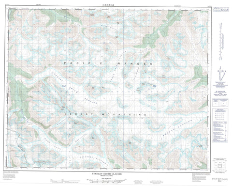
092J13 Stanley Smith Glacier Canada topo map, 1:50,000 scale
092J13 Stanley Smith Glacier NRCAN topographic map.
Includes UTM and GPS geographic coordinates (latitude and longitude). This 50k scale map is suitable for hiking, camping, and exploring, or you could frame it as a wall map.
Printed on-demand using high resolution, on heavy weight and acid free paper, or as an upgrade on a variety of synthetic materials.
Topos available on paper, Waterproof, Poly, or Tyvek. Usually shipping rolled, unless combined with other folded maps in one order.
- Product Number: NRCAN-092J13
- Parent Topo: TOPO-092J
- Map ID also known as: 092J13, 92J13
- Unfolded Size: Approximately 26" high by 36" wide
- Weight (paper map): ca. 55 grams
- Map Type: POD NRCAN Topographic Map
- Map Scale: 1:50,000
- Geographical region: British Columbia, Canada
Neighboring Maps:
All neighboring Canadian topo maps are available for sale online at 1:50,000 scale.
Purchase the smaller scale map covering this area: Topo-092J
Spatial coverage:
Topo map sheet 092J13 Stanley Smith Glacier covers the following places:
- Bishop Glacier - Bridge Glacier - Chapman Glacier - Donar Glacier - Edmond Glacier - Frank Smith Glacier - Lillooet Glacier - Lord Glacier - Magaera Glacier - Monmouth Glacier - Necwtinoaz Glacier - Npigwq Glacier - Qwilqen Glacier - Rifferswil Glacier - Ring Glacier - Skmalts Naxwexnt Glacier - Stalhalam Glacier - Stanley Smith Glacier - Sxwitaoz Glacier - Tchaikazan Glacier - The Four-Way Stop - Toba Glacier - Bridge Peak - Chaîne Côtière - Coast Mountains - Fluted Mountain - Metslaka Keta - Monmouth Mountain - Mount Alecto - Mount Appalus - Mount Binkert - Mount Chloe - Mount Daphnis - Mount Dodds - Mount Donar - Mount Fowler - Mount Fulgora - Mount Heaney - Mount Henderson - Mount Magaera - Mount Mills - Mount Perry - Mount Porter - Mount Sawt - Mount Tait - Mount Taylor - Mount Tisiphone - Mount Tsunamen - Mount Wheatley - Pacific Ranges - Stanley Peak - Transition Peak - White Cross Mountain - Regional District of Comox-Strathcona - T{26}'il{27}os Park - Ts'yl-os Park - Bishop River - Bridge River - Chapman Creek - Edmond Creek - Lord River - Nichols Creek - Ramose Creek - Skmalts Naxwexnt Creek - Xwitslec Col


