
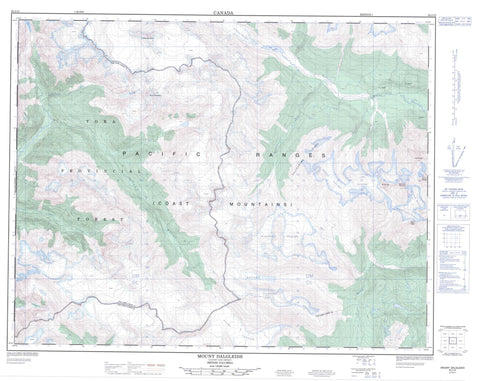
092J12 Mount Dalgleish Canada topo map, 1:50,000 scale
092J12 Mount Dalgleish NRCAN topographic map.
Includes UTM and GPS geographic coordinates (latitude and longitude). This 50k scale map is suitable for hiking, camping, and exploring, or you could frame it as a wall map.
Printed on-demand using high resolution, on heavy weight and acid free paper, or as an upgrade on a variety of synthetic materials.
Topos available on paper, Waterproof, Poly, or Tyvek. Usually shipping rolled, unless combined with other folded maps in one order.
- Product Number: NRCAN-092J12
- Parent Topo: TOPO-092J
- Map ID also known as: 092J12, 92J12
- Unfolded Size: Approximately 26" high by 36" wide
- Weight (paper map): ca. 55 grams
- Map Type: POD NRCAN Topographic Map
- Map Scale: 1:50,000
- Geographical region: British Columbia, Canada
Neighboring Maps:
All neighboring Canadian topo maps are available for sale online at 1:50,000 scale.
Purchase the smaller scale map covering this area: Topo-092J
Spatial coverage:
Topo map sheet 092J12 Mount Dalgleish covers the following places:
- Affliction Glacier - Albino Glacier - Approach Glacier - Beach Glacier - Berm Glacier - Blackfin Glacier - Capricorn Glacier - Dalgleish Glacier - Devastation Glacier - Dolphin Glacier - Exit Glacier - Havoc Glacier - Jimmie Glacier - Job Glacier - Lillooet Glacier - Manatee Glacier - Meager Glacier - Mosaic Glacier - Plateau Icefield - Pylon Glacier - Sirenia Glacier - Toba Glacier - Wave Glacier - Belinda Lake - Berm Lake - Fish Lake - Procyon Lake - Racoon Lakes - Silt Lake - Albacore Peak - Albino Dome - Ballpeen Mountain - Belinda Mountain - Berm Peak - Bonito Peak - Capricorn Mountain - Chaîne Côtière - Clendinning Range - Coast Mountains - Delta Peak - Devastator Peak - Dolphin Peak - Dugong Peak - Elaho Mountain - Elaho Range - Jointed Mountain - Lillooet Mountain - Manatee Peak - Marlin Peak - Meager Mountain - Mermaid Peak - Mittelberg Mountain - Mount Dalgleish - Mount Job - Mount Meager - Mu Peak - Obelia Peak - Oluk Peak - Pacific Ranges - Plinth Peak - Polychrome Ridge - Pylon Peak - Racoon Mountain - Remora Peak - Sirenia Mountain - Teeter Peak - Totter Peak - Wahoo Tower - Upper Lillooet Park - Affliction Creek - Berm Creek - Dalgleish Creek - Devastator Creek - East Toba River - Elaho River - Fish Creek - Jimmie Creek - Job Creek - Lillooet River - Manatee Creek - Meager Creek - Mosaic Creek - Racoon Creek - Slab Creek - Toba River - Wave Creek - Zoltan Creek


