
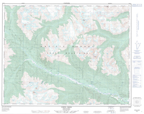
092J11 North Creek Canada topo map, 1:50,000 scale
092J11 North Creek NRCAN topographic map.
Includes UTM and GPS geographic coordinates (latitude and longitude). This 50k scale map is suitable for hiking, camping, and exploring, or you could frame it as a wall map.
Printed on-demand using high resolution, on heavy weight and acid free paper, or as an upgrade on a variety of synthetic materials.
Topos available on paper, Waterproof, Poly, or Tyvek. Usually shipping rolled, unless combined with other folded maps in one order.
- Product Number: NRCAN-092J11
- Parent Topo: TOPO-092J
- Map ID also known as: 092J11, 92J11
- Unfolded Size: Approximately 26" high by 36" wide
- Weight (paper map): ca. 55 grams
- Map Type: POD NRCAN Topographic Map
- Map Scale: 1:50,000
- Geographical region: British Columbia, Canada
Neighboring Maps:
All neighboring Canadian topo maps are available for sale online at 1:50,000 scale.
Purchase the smaller scale map covering this area: Topo-092J
Spatial coverage:
Topo map sheet 092J11 North Creek covers the following places:
- Boomerang Glacier - Freight Glacier - McParlon Glacier - Pebble Glacier - Pemberton Icefield - Siding Glacier - Surfusion Glacier - Thiassi Glacier - Train Glacier - Salmon Slough - Semaphore Lake - Blockhead Mountain - Caboose Mountain - Chaîne Côtière - Coast Mountains - Face Mountain - Faceless Mountain - Fasp Mountain - Handcar Peak - Hemionus Mountain - Locomotive Mountain - Mount Athelstan - Mount Delilah - Mount Pauline - Mount Sampson - Mount Samson - Mount Thiassi - Mount Wake - Overseer Mountain - Pacific Ranges - Pika Peak - Railroad Mountain - Sessel Mountain - Spidery Peak - Spindrift Mountain - Sugus Mountain - Tender Mountain - The Frost Fiend - Squamish-Lillooet Regional District - Boulder Creek - Buck Creek - Capricorn Creek - Cypress Creek - Delilah Creek - Donelly Creek - Fish Creek - Freight Creek - Hurley River - Jamie Creek - Lillooet River - Lone Goat Creek - McParlon Creek - Meager Creek - Mowich Creek - North Creek - Pebble Creek - Perkins Creek - Railroad Creek - Salal Creek - Sampson Creek - Samson Creek - South Creek - Twentyfive Mile Jim Creek - West Jamie Creek - Ash Pass - Glacier Pass - Pemberton Valley - Railroad Pass


