
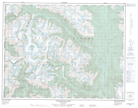
092J05 Clendenning Creek Canada topo map, 1:50,000 scale
092J05 Clendenning Creek NRCAN topographic map.
Includes UTM and GPS geographic coordinates (latitude and longitude). This 50k scale map is suitable for hiking, camping, and exploring, or you could frame it as a wall map.
Printed on-demand using high resolution, on heavy weight and acid free paper, or as an upgrade on a variety of synthetic materials.
Topos available on paper, Waterproof, Poly, or Tyvek. Usually shipping rolled, unless combined with other folded maps in one order.
- Product Number: NRCAN-092J05
- Parent Topo: TOPO-092J
- Map ID also known as: 092J05, 92J5, 92J05
- Unfolded Size: Approximately 26" high by 36" wide
- Weight (paper map): ca. 55 grams
- Map Type: POD NRCAN Topographic Map
- Map Scale: 1:50,000
- Geographical region: British Columbia, Canada
Neighboring Maps:
All neighboring Canadian topo maps are available for sale online at 1:50,000 scale.
Purchase the smaller scale map covering this area: Topo-092J
Spatial coverage:
Topo map sheet 092J05 Clendenning Creek covers the following places:
- Assault Glacier - Battery Glacier - Beach Glacier - Blackfin Glacier - Boardman Glacier - Clendenning Glacier - Clendinning Glacier - Doolittle Glacier - Elaho Glacier - Foreshore Glacier - Havoc Glacier - Military Glacier - Pemberton Icefield - Plateau Icefield - Ross Arm - Rund Glacier - Schlüsselloch Glacier - Surf Glacier - Swiss Arm - Terrific Glacier - Tinniswood Glacier - Volley Glacier - Wave Glacier - Whiting Glacier - Clendenning Lake - Clendinning Lake - Beach Mountain - Blastus Ridge - Blümlisalp Mountain - Bottiger Peak - Breaker Peak - Chaîne Côtière - Clendenning Range - Clendinning Range - Coast Mountains - Comber Peak - Corporal Mountain - Elaho Range - Frontline Mountain - Howitzer Peak - Limpet Ridge - Mount Alexander - Mount Boardman - Mount Casement - Mount Clendenning - Mount Clendinning - Mount Doolittle - Mount George Edwards - Mount Oswald - Mount Perkins - Mount Pollock - Mount Ralph - Mount Thomas - Mount Tinniswood - Mount Vanstone - Mount Whiting - Mount Willson - Pacific Ranges - Pivotal Mountain - Ross Ridge - Sergeant Mountain - Windiger Mountain - Clendenning Park - Clendinning Park - Clendenning Creek - Clendinning Creek - Doolittle Creek - Elaho River - Hunaechin Creek - Little Toba River - Lunar Creek - Sims Creek - Wave Creek - Whiting Creek - Lunar Pass


