
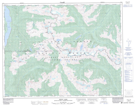
092J01 Stein Lake Canada topo map, 1:50,000 scale
092J01 Stein Lake NRCAN topographic map.
Includes UTM and GPS geographic coordinates (latitude and longitude). This 50k scale map is suitable for hiking, camping, and exploring, or you could frame it as a wall map.
Printed on-demand using high resolution, on heavy weight and acid free paper, or as an upgrade on a variety of synthetic materials.
Topos available on paper, Waterproof, Poly, or Tyvek. Usually shipping rolled, unless combined with other folded maps in one order.
- Product Number: NRCAN-092J01
- Parent Topo: TOPO-092J
- Map ID also known as: 092J01, 92J1, 92J01
- Unfolded Size: Approximately 26" high by 36" wide
- Weight (paper map): ca. 55 grams
- Map Type: POD NRCAN Topographic Map
- Map Scale: 1:50,000
- Geographical region: British Columbia, Canada
Neighboring Maps:
All neighboring Canadian topo maps are available for sale online at 1:50,000 scale.
Purchase the smaller scale map covering this area: Topo-092J
Spatial coverage:
Topo map sheet 092J01 Stein Lake covers the following places:
- Crevasse Crag - Elton Falls - Snake Falls - Rutledge Glacier - Arrowhead Lake - Battleship Lakes - Brimstone Lake - Caltha Lake - Crystal Tarns - Dewdrop Lake - Dragonfly Lake - Elton Lake - Figure Eight Lake - Fried Egg Lake - Haven Lake - Heart Lake - Iceberg Lake - Lillooet Lake - Lizzie Lake - Long Lake - No Camp Lake - Puppet Lake - Rainbow Lake - Salamander Lake - Sapphire Lake - Shields Lake - Snake Lake - Stein Lake - Tao Lake - Tundra Lake - Whisky Lake - Anemone Peak - Arrowhead Mountain - Aurora Peak - Bastion Range - Beacon Mountain - Bellavista Ridge - Brimstone Mountain - Caltha Peak - Chaîne Côtière - Cloudraker Mountain - Coast Mountains - Diversion Peak - Famine Mountain - Famine Ridge - Hanging Mist Peak - Haven Peak - Intern Ridge - Lillooet Ranges - Lindisfarne Mountain - Lizzie Peak - Long Peak - Meadow Dome - Meditation Mountain - Mount Klackarpun - Mount Skook Jim - Pacific Ranges - Phacelia Mountain - Priory Peaks - Pyramidal Peak - Salamander Mountain - Shields Peak - Siamese Twins - Storm Peak - Tabletop Mountain - Tao Peak - Tarn Peak - Tundra Peak - Twin Two Peak - Tynemouth Mountain - Whisky Peak - White Lupine Ridge - Wild Onion Ridge - Fraser Valley Regional District - Regional District of Fraser-Cheam - Mehatl Creek Park - Stein Valley Nlaka'pamux Heritage Park - Raven Flats - Allenby Creek - Elton Creek - Gowan Creek - Lillooet River - Lizzie Creek - Mehatl Creek - Nahatlatch River - North Mehatl Creek - North Stein River - Roger Creek - Rogers Creek - Rutledge Creek - Stein River - Twin One Creek - Twin Two Creek - Van Horlick Creek - Cherry Pip Pass - Moraine Pass


