
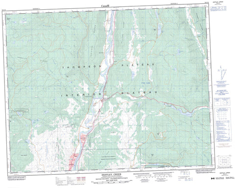
092I16 Heffley Creek Canada topo map, 1:50,000 scale
092I16 Heffley Creek NRCAN topographic map.
Includes UTM and GPS geographic coordinates (latitude and longitude). This 50k scale map is suitable for hiking, camping, and exploring, or you could frame it as a wall map.
Printed on-demand using high resolution, on heavy weight and acid free paper, or as an upgrade on a variety of synthetic materials.
Topos available on paper, Waterproof, Poly, or Tyvek. Usually shipping rolled, unless combined with other folded maps in one order.
- Product Number: NRCAN-092I16
- Parent Topo: TOPO-092I
- Map ID also known as: 092I16, 92I16
- Unfolded Size: Approximately 26" high by 36" wide
- Weight (paper map): ca. 55 grams
- Map Type: POD NRCAN Topographic Map
- Map Scale: 1:50,000
- Geographical region: British Columbia, Canada
Neighboring Maps:
All neighboring Canadian topo maps are available for sale online at 1:50,000 scale.
Purchase the smaller scale map covering this area: Topo-092I
Spatial coverage:
Topo map sheet 092I16 Heffley Creek covers the following places:
- Kamloops Indian Reserve 1 - Kamloops Indian Reserve 5 - Réserve indienne Kamloops 1 - Réserve indienne Kamloops 5 - Réserve indienne Whispering Pines 4 - Whispering Pines Indian Reserve 4 - Andy Lake - Bob Creek - Brown Lake - Community Lake - Devick Lake - Griffin Lake - Heffley Lake - Huff Lake - Inskip Lake - Isobel Lake - Knouff Lake - Lac du Bois - Little Heffley Lake - Long Lake - Louis Lake - Lyons Lake - McQueen Lake - Noble Lake - O'Connor Lake - Orchard Lake - Pass Lake - Richardson Lake - Silentpool Lake - Sullivan Lake - Wentworth Lake - Batchelor Range - Dome Hills - Jamieson Range - Mount Fleet - Mount Hyde - Mount Knouff - Mount Lolo - Mount Wheeler - Opax Hill - Shuswap Highland - Silwhoiakun Mountain - Strawberry Hill - Sullivan Range - Thompson-Nicola Regional District - Lac du Bois Grasslands Park - North Thompson Oxbows Jensen Island Park - Paul Lake Park - Thompson Plateau - Armour Creek - Cahilty Creek - Charles Lee Creek - Christian Creek - Cold Creek - Community Creek - Dairy Creek - Dans Creek - Devick Creek - Edwards Creek - Graham Creek - Heffley Creek - Jamieson Creek - Knouff Creek - Lanes Creek - Lloyd Creek - Louis Creek - McCauley Creek - McKnight Creek - McQueen Creek - Mossey Creek - North Thompson River - Paling Creek - Robbins Creek - Rushton Creek - Seven O Creek - Stuart Creek - Venn Creek - Watching Creek - Wentworth Creek - Williams Creek - Zink Creek - Black Pines - Cahilty - Heffley - Heffley Creek - Knouff Creek - Knouff Lake - Ramage - Rayleigh - Rayleigh Mount - Vinsulla - Westsyde - Blue Ravine


