
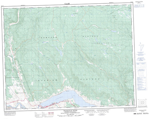
092I15 Tranquille River Canada topo map, 1:50,000 scale
092I15 Tranquille River NRCAN topographic map.
Includes UTM and GPS geographic coordinates (latitude and longitude). This 50k scale map is suitable for hiking, camping, and exploring, or you could frame it as a wall map.
Printed on-demand using high resolution, on heavy weight and acid free paper, or as an upgrade on a variety of synthetic materials.
Topos available on paper, Waterproof, Poly, or Tyvek. Usually shipping rolled, unless combined with other folded maps in one order.
- Product Number: NRCAN-092I15
- Parent Topo: TOPO-092I
- Map ID also known as: 092I15, 92I15
- Unfolded Size: Approximately 26" high by 36" wide
- Weight (paper map): ca. 55 grams
- Map Type: POD NRCAN Topographic Map
- Map Scale: 1:50,000
- Geographical region: British Columbia, Canada
Neighboring Maps:
All neighboring Canadian topo maps are available for sale online at 1:50,000 scale.
Purchase the smaller scale map covering this area: Topo-092I
Spatial coverage:
Topo map sheet 092I15 Tranquille River covers the following places:
- Red Point - Six Mile Point - Sixmile Point - Painted Bluffs - Deadman's Creek Indian Reserve - Réserve indienne Deadman's Creek - Réserve indienne Skeetchestn - Skeetchestn Indian Reserve - Alexander Lake - Andrus Lake - Calder Lake - Carlo Lake - Cayuse Lake - Dynes Lake - Fessenden Lake - Frog Lake - Gisborne Lake - Horace Lake - Kamloops Lake - Moutray Lake - Nelmes Lake - Red Lake - Sabiston Lake - Salstrum Lake - Saul Lake - Sedge Lake - Sparks Lake - Strachan Lake - Sydney Lake - Tranquille Lake - Truda Lake - Wadley Lake - Arrowstone Hills - Carabine Hill - Eagle Hill - Hardie Hill - Mount Uren - Opax Hill - Porcupine Ridge - Silwhoiakun Mountain - Six Mile Hill - Thompson-Nicola Regional District - Painted Bluffs Park - Porcupine Meadows Park - Savona Park - Steelhead Park - Walhachin Oxbows Park - Red Plateau - Scow Flat - Silwhoiakun Plateau - Thompson Plateau - Tranquille Plateau - Barricade Creek - Cannell Creek - Carabine Creek - Charette Creek - Clemes Creek - Criss Creek - Deadman River - Doherty Creek - Durand Creek - Gorge Creek - Heller Creek - Herbert Creek - Jimmies Creek - Rosseau Creek - Sabiston Creek - Saul Creek - Sedge Creek - Silverspring Creek - Sparks Creek - Sylvestre Creek - Thompson River - Tobacco Creek - Tranquille River - Upper Ranch Creek - Watching Creek - Welland Creek - Split Rock - Hudson Bay Springs - Copper Creek - Cultus Lake - Jaleslie - Red Lake - Savona - Savona - Walhachin - Stoddard Meadows


