
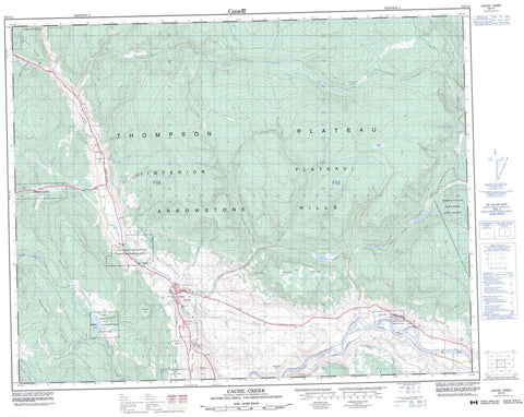
092I14 Cache Creek Canada topo map, 1:50,000 scale
092I14 Cache Creek NRCAN topographic map.
Includes UTM and GPS geographic coordinates (latitude and longitude). This 50k scale map is suitable for hiking, camping, and exploring, or you could frame it as a wall map.
Printed on-demand using high resolution, on heavy weight and acid free paper, or as an upgrade on a variety of synthetic materials.
Topos available on paper, Waterproof, Poly, or Tyvek. Usually shipping rolled, unless combined with other folded maps in one order.
- Product Number: NRCAN-092I14
- Parent Topo: TOPO-092I
- Map ID also known as: 092I14, 92I14
- Unfolded Size: Approximately 26" high by 36" wide
- Weight (paper map): ca. 55 grams
- Map Type: POD NRCAN Topographic Map
- Map Scale: 1:50,000
- Geographical region: British Columbia, Canada
Neighboring Maps:
All neighboring Canadian topo maps are available for sale online at 1:50,000 scale.
Purchase the smaller scale map covering this area: Topo-092I
Spatial coverage:
Topo map sheet 092I14 Cache Creek covers the following places:
- 105 Mile Post Indian Reserve 2 - Bonaparte Indian Reserve 3 - Deadman's Creek Indian Reserve - Grasslands Indian Reserve 7 - Lower Hat Creek Indian Reserve 2 - Mauvais Rocher Indian Reserve 5 - McLean's Lake Indian Reserve 3 - Réserve indienne 105 Mile Post 2 - Réserve indienne Bonaparte 3 - Réserve indienne Deadman's Creek - Réserve indienne Grasslands 7 - Réserve indienne Lower Hat Creek 2 - Réserve indienne Mauvais Rocher 5 - Réserve indienne McLean's Lake 3 - Réserve indienne Skeetchestn - Skeetchestn Indian Reserve - Brousseau Lake - Clemes Lake - Cultus Lake - Gallagher Lakes - McLean Lake - Stinking Lake - Tsotin Lake - Veasy Lake - Arrowstone Hills - Cache Creek Hills - Campbell Hill - Elephant Hill - Hart Ridge - Rattlesnake Hill - Trachyte Hills - Arrowstone Park - Elephant Hill Park - Juniper Beach Park - Boston Flats - Thompson Plateau - Arrowstone Creek - Ashcroft Creek - Barricade Creek - Battle Creek - Bonaparte River - Cache Creek - Charette Creek - Chrome Creek - Clemes Creek - Cornwall Creek - Gallagher Creek - Gorge Creek - Hat Creek - Lopez Creek - MacLaren Creek - Maiden Creek - Medicine Creek - Pioneer Creek - Scottie Creek - Silverspring Creek - Thompson River - Tsotin Creek - Anglesey - Boston Flats - Carquile - Maharg - McAbee - Semlin - Brassy Gulch - Cattle Valley - Edward Gulch - Pass Valley - Semlin Valley - Cache Creek


