
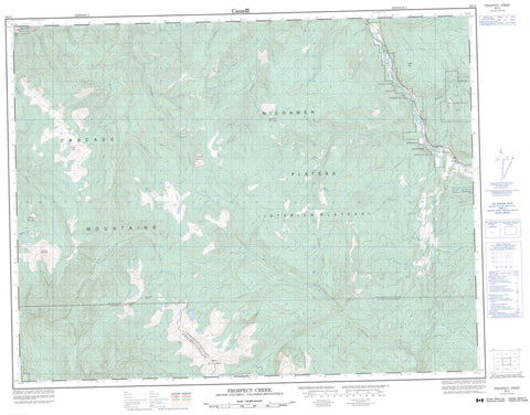
092I03 Prospect Creek Canada topo map, 1:50,000 scale
092I03 Prospect Creek NRCAN topographic map.
Includes UTM and GPS geographic coordinates (latitude and longitude). This 50k scale map is suitable for hiking, camping, and exploring, or you could frame it as a wall map.
Printed on-demand using high resolution, on heavy weight and acid free paper, or as an upgrade on a variety of synthetic materials.
Topos available on paper, Waterproof, Poly, or Tyvek. Usually shipping rolled, unless combined with other folded maps in one order.
- Product Number: NRCAN-092I03
- Parent Topo: TOPO-092I
- Map ID also known as: 092I03, 92I3, 92I03
- Unfolded Size: Approximately 26" high by 36" wide
- Weight (paper map): ca. 55 grams
- Map Type: POD NRCAN Topographic Map
- Map Scale: 1:50,000
- Geographical region: British Columbia, Canada
Neighboring Maps:
All neighboring Canadian topo maps are available for sale online at 1:50,000 scale.
Purchase the smaller scale map covering this area: Topo-092I
Spatial coverage:
Topo map sheet 092I03 Prospect Creek covers the following places:
- Boothroyd Indian Reserve 6A - Nooaitch Grass Indian Reserve 9 - Nooaitch Indian Reserve 10 - Réserve indienne Boothroyd 6A - Réserve indienne Nooaitch 10 - Réserve indienne Nooaitch Grass 9 - Réserve indienne Speous 8 - Speous Indian Reserve 8 - Cascade Mountains - Jackass Mountain - Kanaka Mountain - Lytton Mountains - Mimenuh Mountain - Mount Hewitt Bostock - Mount Lytton - Pulpit Rock - Zakwaski Mountain - Fraser Valley Regional District - Regional District of Fraser-Cheam - Nicoamen Plateau - Thompson Plateau - Abbott Creek - Agate Creek - August Creek - Bar Creek - Barrie Creek - Dud Creek - Edgar Creek - Gladwin Creek - Gordon Creek - Hendy Creek - Jack Swart Creek - Jackswart Creek - James Creek - Lytton Creek - Maka Creek - Manning Creek - Mowhokam Creek - Nicoamen River - Nicola River - Nuaitch Creek - Petit Creek - Platt Creek - Poison Creek - Powers Creek - Prospect Creek - Richardson Creek - Roberts Creek - Saatin Creek - Shackelly Creek - Shakan Creek - Silk Creek - Sinclair Creek - Siska Creek - Siwash Creek - Spius Creek - Teepee Creek - Tent Creek - Thompson River - Walden Creek - Waterfall Creek - Wolden Creek - Canford - Dot - Cowhead Pass - Pole Gulch - Prospect Valley - Sunshine Valley


