
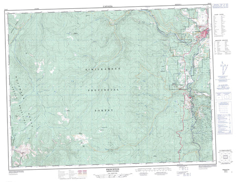
092H07 Princeton Canada topo map, 1:50,000 scale
092H07 Princeton NRCAN topographic map.
Includes UTM and GPS geographic coordinates (latitude and longitude). This 50k scale map is suitable for hiking, camping, and exploring, or you could frame it as a wall map.
Printed on-demand using high resolution, on heavy weight and acid free paper, or as an upgrade on a variety of synthetic materials.
Topos available on paper, Waterproof, Poly, or Tyvek. Usually shipping rolled, unless combined with other folded maps in one order.
- Product Number: NRCAN-092H07
- Parent Topo: TOPO-092H
- Map ID also known as: 092H07, 92H7, 92H07
- Unfolded Size: Approximately 26" high by 36" wide
- Weight (paper map): ca. 55 grams
- Map Type: POD NRCAN Topographic Map
- Map Scale: 1:50,000
- Geographical region: British Columbia, Canada
Neighboring Maps:
All neighboring Canadian topo maps are available for sale online at 1:50,000 scale.
Purchase the smaller scale map covering this area: Topo-092H
Spatial coverage:
Topo map sheet 092H07 Princeton covers the following places:
- Réserve indienne Vermilion Forks 1 - Vermilion Forks Indian Reserve 1 - Allenby Lake - Batie Lake - Burr Lake - Grant Lake - Kennedy Lake - Lodestone Lake - Paddy Pond - Punch Bowl - Smelter Lake - Smelter Lakes - Stevenson Lake - Tracey Lake - Watkins Lake - Wells Lake - Whitecloud Lake - Allenby Mountain - Bedded Range - Cascade Mountains - Copper Mountain - Dear Mountain - Friday Mountain - Granite Mountain - Hozameen Range - Kettle Mountain - Lodestone Mountain - Montgomery Ridge - Mount Kennedy - Skaist Mountain - Snass Mountain - Tanglewood Hill - Warburton Peak - Regional District of Fraser-Cheam - Cascade Recreation Area - E.C. Manning Park - Thompson Plateau - Arrastra Creek - Asp Creek - Badger Creek - Blackeyes Creek - Blakeburn Creek - Bromley Creek - Buchanan Creek - Captain Grant Creek - Champion Creek - Chisholm Creek - Coates Creek - Combination Creek - Corral Creek - Corral Creek - Cunningham Creek - Dalby Creek - Deep Gulch Creek - East Snass Creek - Fifteen Mile Creek - Findlay Creek - Findlay Creek - Fletcher Creek - Fortyfive Mile Creek - Fortyone Mile Creek - Fortyseven Mile Creek - Fortythree Mile Creek - Fourteen Mile Creek - Frenchy Creek - Friday Creek - Gellatly Creek - Granite Creek - Hilton Creek - Holding Creek - Holmes Creek - Hubbard Creek - Jim Kelly Creek - Lamont Creek - Launders Creek - Lodestone Creek - McColl Creek - Newton Creek - Olivine Creek - Packers Creek - Podunk Creek - Railroad Creek - Roany Creek - Robie Creek - Saturday Creek - Similkameen River - Sinnett Creek - Skaist River - Snass Creek - Squakin Creek - Stevenson Creek - Sunday Creek - Tanglewood Creek - Tulameen River - Turnbull Creek - Twelve Mile Creek - Vuich Creek - Whipsaw Creek - White Creek - Wolfe Creek - Princeton - Allenby - Blakeburn - Copper Mountain - East Princeton - Parr - West Princeton - Hope Pass - Lost Horse Gulch - Paradise Valley - Punch Bowl Pass - Dalby Meadows - Hudson Bay Meadows


