
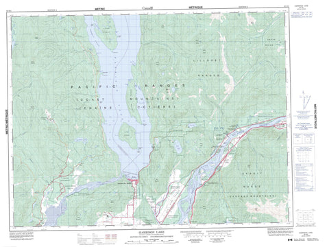
092H05 Harrison Lake Canada topo map, 1:50,000 scale
092H05 Harrison Lake NRCAN topographic map.
Includes UTM and GPS geographic coordinates (latitude and longitude). This 50k scale map is suitable for hiking, camping, and exploring, or you could frame it as a wall map.
Printed on-demand using high resolution, on heavy weight and acid free paper, or as an upgrade on a variety of synthetic materials.
Topos available on paper, Waterproof, Poly, or Tyvek. Usually shipping rolled, unless combined with other folded maps in one order.
- Product Number: NRCAN-092H05
- Parent Topo: TOPO-092H
- Map ID also known as: 092H05, 92H5, 92H05
- Unfolded Size: Approximately 26" high by 36" wide
- Weight (paper map): ca. 55 grams
- Map Type: POD NRCAN Topographic Map
- Map Scale: 1:50,000
- Geographical region: British Columbia, Canada
Neighboring Maps:
All neighboring Canadian topo maps are available for sale online at 1:50,000 scale.
Purchase the smaller scale map covering this area: Topo-092H
Spatial coverage:
Topo map sheet 092H05 Harrison Lake covers the following places:
- Beach Bay - Blind Bay - Camp Cove - Cascade Bay - Celia Cove - Cooks Cove - Crowhurst Bay - Echo Bay - Lakeberg Bay - Long Island Bay - Macs Cove - McComb Bay - McDonalds Bay - Sandy Cove - Scherrer Bay - Sturgeon Bay - Ten Mile Bay - Cascade Peninsula - Pirates Point - Purcell Point - Raake Point - Spooks Point - Ten Mile Point - Whippoorwill Point - Wilson Point - Towboat Strait - Hope - Kent - Eagle Falls - Rainbow Falls - New Westminster Land District - Yale Division Yale Land District - Chawathil Indian Reserve 4 - Chawuthen Indian Reserve 4 - Chehalis Indian Reserve 5 - Chehalis Indian Reserve 6 - Lukseetsissum Indian Reserve 9 - Ohamil Indian Reserve 1 - Peters Indian Reserve 1 - Peters Indian Reserve 1A - Peters Indian Reserve 2 - Réserve indienne Chawathil 4 - Réserve indienne Chawuthen 4 - Réserve indienne Chehalis 5 - Réserve indienne Chehalis 6 - Réserve indienne Lukseetsissum 9 - Réserve indienne Ohamil 1 - Réserve indienne Peters 1 - Réserve indienne Peters 1A - Réserve indienne Peters 2 - Réserve indienne Ruby Creek 2 - Réserve indienne Seabird Island - Réserve indienne Skawahlook 1 - Réserve indienne Wahleach Island 2 - Ruby Creek Indian Reserve 2 - Seabird Island Indian Reserve - Skawahlook Indian Reserve 1 - Wahleach Island Indian Reserve 2 - Camile Island - Cottonwood Island - Deer Island - Echo Island - Herrling Island - Inkman Island - Lone Tree Island - Long Island - Margaret Island - Marguerite Island - Sea Bird Island - Seabird Island - Sheers Island - Vasasus Island - Wadsworth Island - Wahleach Island - Barnet Lake - Bear Lake - Campbell Lake - Chehalis Lake - Comet Lake - Deer Lake - Echo Lake - Elbow Lake - Francis Lake - Grace Lake - Harrison Lake - Hicks Lake - Hotsprings Slough - Johnsons Slough - Lookout Lake - Maria Slough - Morris Lake - Moss Lake - Mountain Slough - Slollicum Lake - Stacey Lake - Sunrise Lake - Trout Lake - Wahleach Lake - Weaver Lake - Wolf Lake - Wood Lake - Bear Mountain - Cascade Mountains - Chaîne Côtière - Coast Mountains - Field Peak - Lillooet Range - Lillooet Ranges - Lookout Peak - Mount Agassiz - Mount Baird - Mount Barr - Mount Davies - Mount Devoy - Mount Downing - Mount Hicks - Mount Keenan - Mount Klaudt - Mount Ludwig - Mount McNair - Mount McRae - Mount Parker - Mount Woodside - Pacific Ranges - Skagit Range - Slollicum Peak - Zofka Ridge - Dewdney-Alouette Regional District - Fraser Valley Regional District - Regional District of Fraser-Cheam - F.H. Barber Park - Sasquatch Park - Weaver Creek Park - American Creek - Bear Creek - Brett Creek - Cartmell Creek - Chawuthen Creek - Chehalis River - Cogburn Creek - Connor Creek - Elbow Creek - Emory Creek - Fleuve Fraser - Fraser River - Garnet Creek - Hale Creek - Harrison River - Hicks Creek - Hunter Creek - Lorenzetta Creek - Mahood Creek - Maisal Creek - McCallum Ditch - Miami Creek - Morris Creek - Pretty Creek - Ruby Creek - Sakwi Creek - Sasquatch Creek - Simms Creek - Skwawolt Creek - Slollicum Creek - Statlu Creek - Stulkawhits Creek - Talc Creek - Thunderbird Creek - Trout Lake Creek - Vaughan Creek - Wahleach Creek - Walian Creek - Weaver Creek - Limbert Rock - Limbert Rocks - Harrison Hot Springs - Cheam View - Cheam View - Flood - Floods - Harrison Mills - Hemlock Valley - Katz - Laidlaw - Ruby Creek - Waleach - Harrison Hot Springs


