
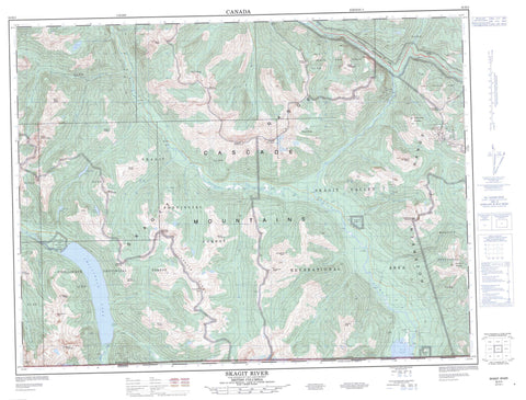
092H03 Skagit River Canada topo map, 1:50,000 scale
092H03 Skagit River NRCAN topographic map.
Includes UTM and GPS geographic coordinates (latitude and longitude). This 50k scale map is suitable for hiking, camping, and exploring, or you could frame it as a wall map.
Printed on-demand using high resolution, on heavy weight and acid free paper, or as an upgrade on a variety of synthetic materials.
Topos available on paper, Waterproof, Poly, or Tyvek. Usually shipping rolled, unless combined with other folded maps in one order.
- Product Number: NRCAN-092H03
- Parent Topo: TOPO-092H
- Map ID also known as: 092H03, 92H3, 92H03
- Unfolded Size: Approximately 26" high by 36" wide
- Weight (paper map): ca. 55 grams
- Map Type: POD NRCAN Topographic Map
- Map Scale: 1:50,000
- Geographical region: British Columbia, Canada
Neighboring Maps:
All neighboring Canadian topo maps are available for sale online at 1:50,000 scale.
Purchase the smaller scale map covering this area: Topo-092H
Spatial coverage:
Topo map sheet 092H03 Skagit River covers the following places:
- Skagit Bluffs - Chilliwack Lake - Clerf Lake - Flora Lake - Greendrop Lake - Hanging Lake - Lindeman Lake - Ross Lake - Swanee Lake - Brown Peak - Camp Peak - Cascade Mountains - Custer Ridge - Eaton Peak - Finlayson Peak - Hatchethead Mountain - Hozameen Range - Jeffrey Peak - Klesilkwa Mountain - Macdonald Peak - Marmot Mountain - Mount Andrews - Mount Brice - Mount Cope - Mount Corriveau - Mount Daly - Mount Edgar - Mount Forddred - Mount Green - Mount Hansen - Mount Holden - Mount Lindeman - Mount Lockwood - Mount McConnell - Mount Meroniuk - Mount Meronuik - Mount Northgraves - Mount Nowell - Mount Payne - Mount Rideout - Mount Tearse - Mount Webb - Mount Wittenberg - Nepopekum Mountain - Paleface Mountain - Shawatum Mountain - Silverdaisy Mountain - Silvertip Mountain - Skagit Range - Thompson Peak - Whitworth Peak - Wright Peak - Fraser Valley Regional District - Regional District of Fraser-Cheam - Cascade Recreation Area - Chilliwack Lake Park - E.C. Manning Park - E.C. Manning Recreation Area - Manning Park - Skagit River Park - Skagit Valley Park - Skagit Valley Recreation Area - Rhododendron Flats - Antimony Creek - Campsite Creek - Cantelon Creek - Centre Creek - Chilliwack River - Cupola Creek - Depot Creek - East Snass Creek - Eaton Creek - Eighteen Mile Creek - Eighteenmile Creek - Forddred Creek - Frances Creek - Galene Creek - Giant Creek - Hicks Creek - International Creek - Klesilkwa River - Laforgue Creek - Maimen Creek - Marmotte Creek - Maselpanik Creek - McNaught Creek - Nepopekum Creek - Norwegian Creek - Paleface Creek - Poland Creek - Post Creek - Potter Creek - Pyrrhotite Creek - Radium Creek - Shawatum Creek - Silverdaisy Creek - Silverhope Creek - Silvertipped Creek - Skagit River - Smitheram Creek - Snass Creek - St. Alice Creek - Star Group Creek - Sumallo River - Swanee Creek - Tearse Creek - Trail Creek - Twenty Mile Creek - Twentyeight Mile Creek - Twentysix Mile Creek - Yola Creek


