
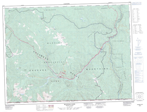
092H02 Manning Park Canada topo map, 1:50,000 scale
092H02 Manning Park NRCAN topographic map.
Includes UTM and GPS geographic coordinates (latitude and longitude). This 50k scale map is suitable for hiking, camping, and exploring, or you could frame it as a wall map.
Printed on-demand using high resolution, on heavy weight and acid free paper, or as an upgrade on a variety of synthetic materials.
Topos available on paper, Waterproof, Poly, or Tyvek. Usually shipping rolled, unless combined with other folded maps in one order.
- Product Number: NRCAN-092H02
- Parent Topo: TOPO-092H
- Map ID also known as: 092H02, 92H2, 92H02
- Unfolded Size: Approximately 26" high by 36" wide
- Weight (paper map): ca. 55 grams
- Map Type: POD NRCAN Topographic Map
- Map Scale: 1:50,000
- Geographical region: British Columbia, Canada
Neighboring Maps:
All neighboring Canadian topo maps are available for sale online at 1:50,000 scale.
Purchase the smaller scale map covering this area: Topo-092H
Spatial coverage:
Topo map sheet 092H02 Manning Park covers the following places:
- Nepopekum Falls - Shadow Falls - Similkameen Falls - Similkameen Division Yale Land District - Yale Division Yale Land District - Beavertree Lake - Flash Lake - Garrison Lakes - Lightning Lake - Nicomen Lake - Poland Lake - Shadow Lake - Strike Lake - Thunder Lake - Twenty Minute Lake - Big Buck Mountain - Blackwall Peak - Bojo Mountain - Bonnevier Ridge - Cascade Mountains - Chuwanten Mountain - Fourth Brother Mountain - Frosty Mountain - Grassy Mountain - Hozameen Range - Lone Goat Mountain - Lone Man Ridge - Lone Mountain - Mount Angus - Mount Kelly - Nicomen Ridge - Okanagan Range - Porcupine Peak - Red Mountain - Snow Camp Mountain - Spotted Nellie Ridge - Three Brothers Mountain - Windy Joe Mountain - Fraser Valley Regional District - Regional District of Fraser-Cheam - Cascade Recreation Area - E.C. Manning Park - E.C. Manning Recreation Area - Manning Park - Skagit River Park - Skagit Valley Recreation Area - Strawberry Flats - Thompson Plateau - Manning Park - Belgie Creek - Bell Creek - Big Burn Creek - Bonnevier Creek - Boundary Creek - Buckhorn Creek - Cable Creek - Calcite Creek - Captain Grant Creek - Castle Creek - Chuwanten Creek - Copper Creek - Crowley Creek - Daynor Creek - Fat Dog Creek - Frosty Creek - Goodfellow Creek - Grainger Creek - Hampton Creek - Lightning Creek - Little Muddy Creek - Memaloose Creek - Middle Creek - Monument Creek - Mowich Creek - Nepopekum Creek - Norwegian Creek - Pasayten River - Passage Creek - Peeve Creek - Perdue Creek - Pinewoods Creek - Placer Creek - Poland Creek - Sandstone Creek - Similkameen River - Skagit River - Skaist River - Smitheram Creek - South Lightning Creek - Sunday Creek - Taboo Creek - Trail Creek - Turnbull Creek - Eastgate - Manning Park - Manning Park - Allison Pass - Despair Pass - Gibson Pass - McDiarmid Meadows


