
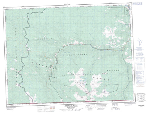
092H01 Ashnola River Canada topo map, 1:50,000 scale
092H01 Ashnola River NRCAN topographic map.
Includes UTM and GPS geographic coordinates (latitude and longitude). This 50k scale map is suitable for hiking, camping, and exploring, or you could frame it as a wall map.
Printed on-demand using high resolution, on heavy weight and acid free paper, or as an upgrade on a variety of synthetic materials.
Topos available on paper, Waterproof, Poly, or Tyvek. Usually shipping rolled, unless combined with other folded maps in one order.
- Product Number: NRCAN-092H01
- Parent Topo: TOPO-092H
- Map ID also known as: 092H01, 92H1, 92H01
- Unfolded Size: Approximately 26" high by 36" wide
- Weight (paper map): ca. 55 grams
- Map Type: POD NRCAN Topographic Map
- Map Scale: 1:50,000
- Geographical region: British Columbia, Canada
Neighboring Maps:
All neighboring Canadian topo maps are available for sale online at 1:50,000 scale.
Purchase the smaller scale map covering this area: Topo-092H
Spatial coverage:
Topo map sheet 092H01 Ashnola River covers the following places:
- Similkameen Division Yale Land District - Ashnola Indian Reserve 10 - Réserve indienne Ashnola 10 - Border Lake - Cathedral Lakes - Glacier Lake - Goat Lake - Haystack Lakes - Ladyslipper Lake - Lake of the Woods - Placer Lake - Pyramid Lake - Quiniscoe Lake - Red Bridge Lake - Scout Lake - Trapper Lake - Cascade Mountains - Cathedral Ridge - Crater Mountain - Denture Ridge - Flat Top Mountain - Grimface Mountain - Haystack Mountain - Lakeview Mountain - Macabre Tower - Matriarch Mountain - Mount Ewart - Okanagan Range - Orthodox Mountain - Placer Mountain - Pyramid Mountain - Quiniscoe Mountain - Red Mountain - The Boxcar - The Deacon - Twin Buttes - Cathedral Park - Thompson Plateau - British Columbia - Ashnola River - Beaver Creek - Belgie Creek - Broken Creek - Cahill Creek - Calcite Creek - Cathedral Fork - Cool Creek - Crater Creek - Duruisseau Creek - Easygoing Creek - Etches Creek - Ewart Creek - Gillanders Creek - Haig Creek - Ikwadli Creek - Juniper Creek - Lakeview Creek - McBride Creek - Meausette Creek - Mountain Goat Creek - Paul Creek - Peeve Creek - Pettigrew Creek - Placer Creek - Quiniscoe Creek - Rattlesnake Creek - Red Bridge Creek - Similkameen River - Skwekust Creek - Smith Creek - Spring Creek - Strayhorse Creek - Sunday Creek - Wall Creek - Webster Creek - Willis Creek - Young Creek - Red Mountain Meadows - Wall Creek Meadows


