
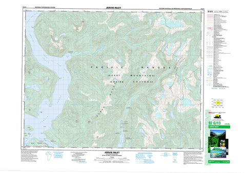
092G13 Jervis Inlet Canada topo map, 1:50,000 scale
092G13 Jervis Inlet NRCAN topographic map.
Includes UTM and GPS geographic coordinates (latitude and longitude). This 50k scale map is suitable for hiking, camping, and exploring, or you could frame it as a wall map.
Printed on-demand using high resolution, on heavy weight and acid free paper, or as an upgrade on a variety of synthetic materials.
Topos available on paper, Waterproof, Poly, or Tyvek. Usually shipping rolled, unless combined with other folded maps in one order.
- Product Number: NRCAN-092G13
- Parent Topo: TOPO-092G
- Map ID also known as: 092G13, 92G13
- Unfolded Size: Approximately 26" high by 36" wide
- Weight (paper map): ca. 55 grams
- Map Type: POD NRCAN Topographic Map
- Map Scale: 1:50,000
- Geographical region: British Columbia, Canada
Neighboring Maps:
All neighboring Canadian topo maps are available for sale online at 1:50,000 scale.
Purchase the smaller scale map covering this area: Topo-092G
Spatial coverage:
Topo map sheet 092G13 Jervis Inlet covers the following places:
- Agamemnon Bay - Dark Cove - Goliath Bay - Granville Bay - Hotham Sound - Jervis Inlet - Killam Bay - Narrows Inlet - Sechelt Inlet - Secret Bay - Vancouver Bay - Dacres Point - Egmont Point - Foley Head - Nile Point - Sechelt Peninsula - Agamemnon Channel - Agnew Passage - Skookumchuck Narrows - Moorsam Bluff - Saumarez Bluff - Harmony Falls - Chickwat Indian Reserve 9 - Egmont Indian Reserve 26 - Klayekwim Indian Reserve 6 - Klayekwim Indian Reserve 6A - Klayekwim Indian Reserve 7 - Klayekwim Indian Reserve 8 - Réserve indienne Chickwat 9 - Réserve indienne Egmont 26 - Réserve indienne Klayekwim 6 - Réserve indienne Klayekwim 6A - Réserve indienne Klayekwim 7 - Réserve indienne Klayekwim 8 - Réserve indienne Skwawkweehm 17 - Skwawkweehm Indian Reserve 17 - Captain Island - East Point Islet - Miller Islet - Nelson Island - Sutton Islets - Sydney Island - Bear Lake - Falk Lake - Freil Lake - Misery Lake - Phantom Lake - Saumarez Lake - Tatlow Lake - Tyson Lakes - Tzoonie Lake - Chaîne Côtière - Coast Mountains - Earle Range - Marlborough Heights - Mount Calder - Mount Churchill - Mount Drew - Mount Foley - Mount Louie - Mount Spencer - Mount Sumner - Pacific Ranges - Tzoonie Mountain - Squamish-Lillooet Regional District - Sunshine Coast Regional District - Chickwat SB 9 - Egmont SB 26 - Klayekwim SB 6 - Klayekwim SB 6A - Klayekwim SB 7 - Klayekwim SB 8 - Skwawkweehm SB 17 - Ashlu Creek - Bear Creek - Chickwat Creek - Clowhom River - Earle Creek - Falk Creek - Freil Creek - Glacial Creek - High Creek - Lapan Creek - Misery Creek - Perketts Creek - Ramona Creek - Stakawus Creek - Tatlow Creek - Treat Creek - Tyson Creek - Tzoonie River - Vancouver River - Prince of Wales Reach - Princess Royal Reach - Egmont - Sechelt Indian Government District


