
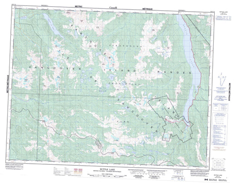
092F12 Buttle Lake Canada topo map, 1:50,000 scale
092F12 Buttle Lake NRCAN topographic map.
Includes UTM and GPS geographic coordinates (latitude and longitude). This 50k scale map is suitable for hiking, camping, and exploring, or you could frame it as a wall map.
Printed on-demand using high resolution, on heavy weight and acid free paper, or as an upgrade on a variety of synthetic materials.
Topos available on paper, Waterproof, Poly, or Tyvek. Usually shipping rolled, unless combined with other folded maps in one order.
- Product Number: NRCAN-092F12
- Parent Topo: TOPO-092F
- Map ID also known as: 092F12, 92F12
- Unfolded Size: Approximately 26" high by 36" wide
- Weight (paper map): ca. 55 grams
- Map Type: POD NRCAN Topographic Map
- Map Scale: 1:50,000
- Geographical region: British Columbia, Canada
Neighboring Maps:
All neighboring Canadian topo maps are available for sale online at 1:50,000 scale.
Purchase the smaller scale map covering this area: Topo-092F
Spatial coverage:
Topo map sheet 092F12 Buttle Lake covers the following places:
- Myra Falls - Île de Vancouver - Vancouver Island - Arnica Lake - Burman Lake - Buttle Lake - Carter Lake - Carwithen Lake - Copper Bush Lake - Crystal Lake - Donner Lake - Emerald Lake - Fairbairn Lake - Globe Flower Lake - Greenview Lake - Greig Lake - Harvey Lake - Hellebore Lake - Hutton Lake - Jim Mitchell Lake - Kunlin Lake - Limestone Lake - Marblerock Lake - Marsh Marigold Lake - McIntyre Lake - McNish Lake - Owen Lake - Rowbotham Lake - Schjelderup Lake - Tennent Lake - Thelwood Lake - Upper Thelwood Lake - Wheaton Lake - El Piveto Mountain - Flower Ridge - Golden Hinde - Greig Ridge - Marble Peak - Matchlee Mountain - Mount Burman - Mount Colonel Foster - Mount Con Reid - Mount DeVoe - Mount Donner - Mount Kent - Mount Kent-Urquhart - Mount McBride - Mount Myra - Mount Phillips - Mount Thelwood - Mount Urquhart - Moyeha Mountain - Ms. Mountain - Phillips Ridge - Popsicle Peak - Rambler Peak - Splendor Mountain - The Behinde - Vancouver Island Mountains - Vancouver Island Ranges - Regional District of Alberni-Clayoquot - Strathcona Park - Strathcona Recreation Area - Strathcona-Myra Park - Strathcona-Westmin Park - Arnica Creek - Bancroft Creek - Burman River - Carwithen Creek - Cervus Creek - East Tennent Creek - Elk River - Greig Creek - Henshaw Creek - Karst Creek - Kowus Creek - Marble Creek - Marblerock Creek - Matchlee Creek - Megin River - Mitla Creek - Moyeha River - Myra Creek - Pamela Creek - Phillips Creek - Price Creek - Quatchka Creek - Ralph River - Shepherd Creek - Tennent Creek - Thelwood Creek - Ucona River - Wolf River - Marble Meadows


