
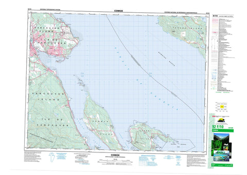
092F10 Comox Canada topo map, 1:50,000 scale
092F10 Comox NRCAN topographic map.
Includes UTM and GPS geographic coordinates (latitude and longitude). This 50k scale map is suitable for hiking, camping, and exploring, or you could frame it as a wall map.
Printed on-demand using high resolution, on heavy weight and acid free paper, or as an upgrade on a variety of synthetic materials.
Topos available on paper, Waterproof, Poly, or Tyvek. Usually shipping rolled, unless combined with other folded maps in one order.
- Product Number: NRCAN-092F10
- Parent Topo: TOPO-092F
- Map ID also known as: 092F10, 92F10
- Unfolded Size: Approximately 26" high by 36" wide
- Weight (paper map): ca. 55 grams
- Map Type: POD NRCAN Topographic Map
- Map Scale: 1:50,000
- Geographical region: British Columbia, Canada
Neighboring Maps:
All neighboring Canadian topo maps are available for sale online at 1:50,000 scale.
Purchase the smaller scale map covering this area: Topo-092F
Spatial coverage:
Topo map sheet 092F10 Comox covers the following places:
- Beale Cove - Buckley Bay - Comox Harbour - Davis Bay - Fanny Bay - Ford Cove - Henry Bay - Kye Bay - Little River Bay - Maple Bay - Spratt Bay - Tribune Bay - Union Bay - Welcome Bay - Whaling Station Bay - Little River Beach - Sandpiper Beach - Butterfly Point - Cape Gurney - Cape Lazo - Collishaw Point - Denman Point - Downes Point - Dunlop Point - Favada Point - Gartley Point - Goose Spit - Longbeak Point - Manning Point - Phipps Point - Shields Point - Shingle Spit - Ship Peninsula - Ship Point - Spray Point - St. John Point - Tralee Point - Union Point - Whalebone Point - White Spit - Baynes Sound - Lambert Channel - Malaspina Strait - Strait of Georgia - Courtenay - Komas Bluff - River Bluff - Robb Bluff - Willemar Bluff - Comox Land District - Nanaimo Land District - Nelson Land District - Newcastle Land District - Texada Island Land District - Comox Indian Reserve 1 - Goose Spit Indian Reserve 3 - Pentledge Indian Reserve 2 - Réserve indienne Comox 1 - Réserve indienne Goose Spit 3 - Réserve indienne Pentledge 2 - Denman Island - Flora Islet - Hornby Island - Île de Vancouver - Sandy Island - Seal Islets - Texada Island - Vancouver Island - Balkwill Lake - Bradley Lake - Case Lake - Chicadee Lake - Cranby Lake - Emily Lake - Graham Lake - Kirk Lake - Langley Lake - Myrtle Lake - Paxton Lake - Priest Lake - Spectacle Lake - Base des Forces canadiennes Comox - Canadian Forces Base Comox - Mount Geoffrey - Nob Hill - Surprise Mountain - Vancouver Island Mountains - Vancouver Island Ranges - Comox Valley Regional District - Powell River Regional District - Regional District of Comox-Strathcona - Fillongley Park - Helliwell Park - Kin Beach Park - Sandy Island Marine Park - Sandy Island Park - Tribune Bay Park - Base Flat - Beacon Creek - Beaufort Creek - Beulah Creek - Bloedel Creek - Brooklyn Creek - Case Creek - Copeman Creek - Courtenay River - Cowie Creek - Fillongley Creek - Ford Creek - Glen Urquhart Creek - Hart Creek - Hindoo Creek - Lard Creek - Little George Creek - Little River - Millard Creek - Myrtle Creek - Piercy Creek - Puntledge River - Roy Creek - Rumbottle Creek - Spence Creek - Trent River - Tsable River - Tsolum River - Tumblewater Creek - Van Anda Creek - Vananda Creek - Achilles Bank - Ajax Bank - Comox Bar - Exeter Shoal - Nash Bank - Palliser Rock - Savoie Rocks - Comox - Balmoral Beach - Bayton - Buckley Bay - Denman Island - Fanny Bay - Fanny Bay - Hornby Island - Hornby Island - Lazo - Little River - Marshall School Junction - Royston - Sandwick - Union Bay


