
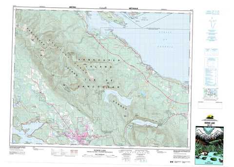
092F07 Horne Lake Canada topo map, 1:50,000 scale
092F07 Horne Lake NRCAN topographic map.
Includes UTM and GPS geographic coordinates (latitude and longitude). This 50k scale map is suitable for hiking, camping, and exploring, or you could frame it as a wall map.
Printed on-demand using high resolution, on heavy weight and acid free paper, or as an upgrade on a variety of synthetic materials.
Topos available on paper, Waterproof, Poly, or Tyvek. Usually shipping rolled, unless combined with other folded maps in one order.
- Product Number: NRCAN-092F07
- Parent Topo: TOPO-092F
- Map ID also known as: 092F07, 92F7, 92F07
- Unfolded Size: Approximately 26" high by 36" wide
- Weight (paper map): ca. 55 grams
- Map Type: POD NRCAN Topographic Map
- Map Scale: 1:50,000
- Geographical region: British Columbia, Canada
Neighboring Maps:
All neighboring Canadian topo maps are available for sale online at 1:50,000 scale.
Purchase the smaller scale map covering this area: Topo-092F
Spatial coverage:
Topo map sheet 092F07 Horne Lake covers the following places:
- Deep Bay - Fanny Bay - Ford Cove - Gravelly Bay - Metcalf Bay - Mud Bay - Port Alberni - Qualicum Bay - Stirling Arm - Two Rivers Arm - Boyle Point - Eagle Point - Faber Point - Mapleguard Point - Norman Point - Reef Point - Repulse Point - Ship Peninsula - Stirling Head - Baynes Sound - Lambert Channel - Strait of Georgia - Port Alberni - Little Qualicum Falls - Stamp Falls - Cathedral Grove - Alberni Land District - Cameron Land District - Clayoquot Land District - Nanaimo Land District - Newcastle Land District - Ahahswinis Indian Reserve 1 - Klehkoot Indian Reserve 2 - Qualicum Indian Reserve - Réserve indienne Ahahswinis 1 - Réserve indienne Klehkoot 2 - Réserve indienne Qualicum - Réserve indienne Tsahaheh 1 - Tsahaheh Indian Reserve 1 - Chrome Island - Denman Island - Hornby Island - Île de Vancouver - Johnstone Island - Toby Island - Vancouver Island - Boot Lagoon - Cameron Lake - Devils Den Lake - Esary Lake - Great Central Lake - Horne Lake - Illusion Lakes - Lacy Lake - Loon Lake - Marshy Lake - McCoy Lake - Patterson Lake - Shoreline Lake - Somers Lake - Spider Lake - Sproat Lake - St. Mary Lake - Summit Lake - Sumner Lake - Sundew Lake - Turtle Lake - Ward Lake - Beaufort Range - Hals Mountain - Mount Apps - Mount Curran - Mount Hal - Mount Horne - Mount Irwin - Mount Joan - Mount Mark - Mount Schofield - Mount Wesley - The Squarehead - Vancouver Island Mountains - Vancouver Island Ranges - Wesley Ridge - Regional District of Alberni-Clayoquot - Regional District of Comox-Strathcona - Regional District of Nanaimo - Boyle Point Park - Cameron Lake Park - Fosselli Park - Fossli Park - Helliwell Park - Horne Lake Caves Park - Lieutenant Ian Philip MacDonald Picnic Area - Little Qualicum Falls Park - MacDonald Picnic Area - MacMillan Park - Mount Arrowsmith Park - Rosewall Creek Park - Spider Lake Park - Sproat Lake Park - Stamp Falls Park - Stamp River Money's Pool Park - Stamp River Park - Annie Creek - Ash River - Bear Creek - Beaver Creek - Cameron River - Chef Creek - Chef Creek - Cherry Creek - Cold Creek - Cook Creek - Cougar Smith Creek - Cowie Creek - Deer Creek - Demens Creek - Hal Creek - Heath Creek - Hunts Creek - Kaka Creek - Kinkade Creek - Kitsucksus Creek - Lanterman Creek - Little Qualicum River - Lockwood Creek - Lugrin Creek - Lymn Creek - McBey Creek - McCoy Creek - McNaughton Creek - Mollet Creek - Nile Creek - Nook Creek - North Tumblewater Creek - Platzer Creek - Qualicum River - Roaring Creek - Robertson Creek - Rogers Creek - Rosewall Creek - Sandy Creek - Shuhum Creek - Somass River - Spaht Creek - Sproat River - Stamp River - Stokes Creek - Thames Creek - Tumblewater Creek - Ward Creek - Waterloo Creek - Whisky Creek - Wilfred Creek - Wolf Creek - Eagle Rock - Heron Rocks - Maude Reef - Norris Rocks - Alberni - Apenes - Arrowsmith - Bainbridge - Beaver Creek - Bostock - Bowser - Cameron Lake - Cherry Creek - Cherry Creek Valley - Dashwood - Deep Bay - Dunsmuir - Fanny Bay - Farris - Great Central - Kleecoot - Mud Bay - Qualicum Bay - Sahara Heights - Solly - Sproat Lake - Stokes - Whisky Creek - Tumblewater Meadows - Whiskey-jack Marsh


