
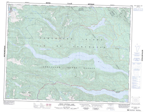
092F06 Great Central Lake Canada topo map, 1:50,000 scale
092F06 Great Central Lake NRCAN topographic map.
Includes UTM and GPS geographic coordinates (latitude and longitude). This 50k scale map is suitable for hiking, camping, and exploring, or you could frame it as a wall map.
Printed on-demand using high resolution, on heavy weight and acid free paper, or as an upgrade on a variety of synthetic materials.
Topos available on paper, Waterproof, Poly, or Tyvek. Usually shipping rolled, unless combined with other folded maps in one order.
- Product Number: NRCAN-092F06
- Parent Topo: TOPO-092F
- Map ID also known as: 092F06, 92F6, 92F06
- Unfolded Size: Approximately 26" high by 36" wide
- Weight (paper map): ca. 55 grams
- Map Type: POD NRCAN Topographic Map
- Map Scale: 1:50,000
- Geographical region: British Columbia, Canada
Neighboring Maps:
All neighboring Canadian topo maps are available for sale online at 1:50,000 scale.
Purchase the smaller scale map covering this area: Topo-092F
Spatial coverage:
Topo map sheet 092F06 Great Central Lake covers the following places:
- Taylor Arm - Two Rivers Arm - Clark Point - Beauty Island - Ash Lake - Brigade Lake - Castle Lake - Dickson Lake - Doran Lake - Elsie Lake - Great Central Lake - Green Lake - Helen Lake - Homasum Lake - June Lake - Junior Lake - Lake Rosemarie - Lois Lake - Lowry Lake - Margaret Lake - McBride Lake - McLaughlin Lake - Mercs Lake - Moran Lake - Nimnim Lake - Norgar Lake - Oshinow Lake - Patterson Lake - Pear Lake - Puntledge Lake - Round Lake - Sproat Lake - Toy Lake - Turnbull Lake - View Lake - Beaufort Range - Klitsa Mountain - Maitland Range - Misthorn - Mount Bueby - Mount Gibson - Mount Henry Spencer - Mount Porter - Pogo Mountain - Thunder Mountain - Vancouver Island Mountains - Vancouver Island Ranges - Regional District of Alberni-Clayoquot - Strathcona Park - Taylor Arm Park - Ash River - Bookhout Creek - Clayoquot River - Clutesi Creek - Dorothy Creek - Drinkwater Creek - Forestry Camp Creek - Friesen Creek - Gretchen Creek - Haa-ak-suuk Creek - Katlum Creek - Kennedy River - Lanterman Creek - Margaret Creek - McBride Creek - Price Creek - Puntledge River - Ramsay Creek - Red Pillar Creek - South Sutton Creek - Sutton Creek - Taylor River - Tofino Creek - Wolf Creek - French Creek - Sutton Pass


