
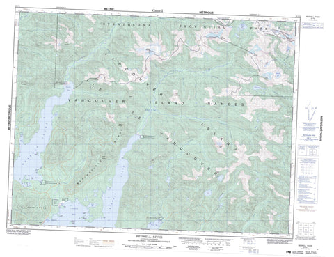
092F05 Bedwell River Canada topo map, 1:50,000 scale
092F05 Bedwell River NRCAN topographic map.
Includes UTM and GPS geographic coordinates (latitude and longitude). This 50k scale map is suitable for hiking, camping, and exploring, or you could frame it as a wall map.
Printed on-demand using high resolution, on heavy weight and acid free paper, or as an upgrade on a variety of synthetic materials.
Topos available on paper, Waterproof, Poly, or Tyvek. Usually shipping rolled, unless combined with other folded maps in one order.
- Product Number: NRCAN-092F05
- Parent Topo: TOPO-092F
- Map ID also known as: 092F05, 92F5, 92F05
- Unfolded Size: Approximately 26" high by 36" wide
- Weight (paper map): ca. 55 grams
- Map Type: POD NRCAN Topographic Map
- Map Scale: 1:50,000
- Geographical region: British Columbia, Canada
Neighboring Maps:
All neighboring Canadian topo maps are available for sale online at 1:50,000 scale.
Purchase the smaller scale map covering this area: Topo-092F
Spatial coverage:
Topo map sheet 092F05 Bedwell River covers the following places:
- Bedingfield Bay - Bedwell Sound - Cypress Bay - Gibson Cove - Hecate Bay - Herbert Arm - Herbert Inlet - Mosquito Harbour - Moyeha Bay - Quait Bay - Warn Bay - Whitepine Cove - Rant Point - Turn Point - Bare Bluff - Della Falls - Clayoquot Land District - Taylor Glacier - Moyehai Indian Reserve 23 - Oinimitis Indian Reserve 14 - Peneetle Indian Reserve 22 - Quortsowe Indian Reserve 13 - Réserve indienne Moyehai 23 - Réserve indienne Oinimitis 14 - Réserve indienne Peneetle 22 - Réserve indienne Quortsowe 13 - Réserve indienne Wahous 19 - Réserve indienne Wahous 20 - Wahous Indian Reserve 19 - Wahous Indian Reserve 20 - Binns Island - Île de Vancouver - Knocker Islet - McLeod Island - Observation Islet - Rhodes Island - River Island - Vancouver Island - Welcome Island - Andrew Lake - Beauty Lake - Bedwell Lake - Cream Lake - Della Lake - Leader lake - Love Lake - Paradise Lake - Abco Mountain - Bedingfield Range - Big Interior Mountain - Catface Mountains - Catface Range - Lone Wolf Mountain - Mariner Mountain - Mount Cotter - Mount Drew - Mount Guemes - Mount Quimper - Mount Rosseau - Mount Saavedra - Mount Septimus - Mount Tom Taylor - Mount Wood - Nine Peaks - Rhino Peak - Shelbert Mountain - Steeple Mountain - Ursus Mountain - Valella Peak - Vancouver Island Mountains - Vancouver Island Ranges - Velella Peak - Regional District of Alberni-Clayoquot - Strathcona Park - Strathcona Recreation Area - Tranquil Creek Park - Abco Creek - Ashwood Creek - Balbo Creek - Bawden Creek - Bedwell River - Blaney Creek - Bulson Creek - Cotter Creek - Cream Creek - Cypre River - Drinkwater Creek - Kennedy River - Kowus Creek - Love Creek - Mariner Creek - McBride Creek - Megin River - Mitla Creek - Moyeha River - Noble Creek - Penny Creek - Price Creek - Sam Craig Creek - Shelter Creek - Taylor River - Thunderbird Creek - Tofino Creek - Tranquil Creek - Ursus Creek - Watta Creek - You Creek - Mussel Rock - Sutlej Rock


