
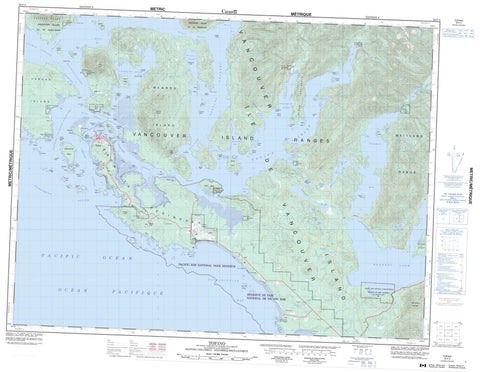
092F04 Tofino Canada topo map, 1:50,000 scale
092F04 Tofino NRCAN topographic map.
Includes UTM and GPS geographic coordinates (latitude and longitude). This 50k scale map is suitable for hiking, camping, and exploring, or you could frame it as a wall map.
Printed on-demand using high resolution, on heavy weight and acid free paper, or as an upgrade on a variety of synthetic materials.
Topos available on paper, Waterproof, Poly, or Tyvek. Usually shipping rolled, unless combined with other folded maps in one order.
- Product Number: NRCAN-092F04
- Parent Topo: TOPO-092F
- Map ID also known as: 092F04, 92F4, 92F04
- Unfolded Size: Approximately 26" high by 36" wide
- Weight (paper map): ca. 55 grams
- Map Type: POD NRCAN Topographic Map
- Map Scale: 1:50,000
- Geographical region: British Columbia, Canada
Neighboring Maps:
All neighboring Canadian topo maps are available for sale online at 1:50,000 scale.
Purchase the smaller scale map covering this area: Topo-092F
Spatial coverage:
Topo map sheet 092F04 Tofino covers the following places:
- Adventure Cove - Berryman Cove - Cannery Bay - Clayoquot Arm - Cox Bay - Deer Bay - Disappointment Inlet - Duffin Cove - English Cove - Florencia Bay - Grice Bay - Gunner Harbour - Gunner Inlet - Hecate Bay - Heelboom Bay - Indian Bay - Irving Cove - Island Cove - Kennedy Cove - Lemmens Inlet - Long Bay - Mill Bay - Mosquito Harbour - Mud Bay - Rankin Cove - Ritchie Bay - Schooner Cove - Tofino Inlet - Tranquil Inlet - Warn Bay - Wickaninnish Bay - Windy Arm - Windy Bay - Chesterman Beach - Long Beach - MacKenzie Beach - Radar Beaches - Auseth Point - Berryman Point - Corning Point - Cox Point - Esowista Peninsula - Ginnard Point - Green Point - Grice Point - Kraan Head - Low Peninsula - McCaw Peninsula - Meares Spit - Moser Point - Plover Point - Point Cox - Portland Point - Rassier Point - Robert Point - Schindler Point - Ten Mile Point - Usatzes Point - Browning Passage - Calmus Passage - Clayoquot Sound - Dawley Passage - Deadman Passage - Deception Channel - Duffin Passage - Epper Passage - Father Charles Channel - Fortune Channel - Heynen Channel - Matlset Narrows - Maurus Channel - Race Narrows - Templar Channel - Tsapee Narrows - Van Nevel Channel - Tofino - Clayoqua Indian Reserve 6 - Cloolthpich Indian Reserve 12 - Echachis Indian Reserve 2 - Eelseuklis Indian Reserve 10 - Esowista Indian Reserve 3 - Ilthpaya Indian Reserve 8 - Indian Island Indian Reserve 30 - Kootowis Indian Reserve 4 - Okeamin Indian Reserve 5 - Onadsilth Indian Reserve 9 - Opitsat Indian Reserve 1 - Quisitis Indian Reserve 9 - Réserve indienne Clayoqua 6 - Réserve indienne Cloolthpich 12 - Réserve indienne Echachis 2 - Réserve indienne Eelseuklis 10 - Réserve indienne Esowista 3 - Réserve indienne Ilthpaya 8 - Réserve indienne Indian Island 30 - Réserve indienne Kootowis 4 - Réserve indienne Okeamin 5 - Réserve indienne Onadsilth 9 - Réserve indienne Opitsat 1 - Réserve indienne Quisitis 9 - Réserve indienne Sutaquis 18 - Réserve indienne Tin Wis 11 - Réserve indienne Vargas Island 31 - Réserve indienne Wya 7 - Réserve indienne Yarksis 11 - Sutaquis Indian Reserve 18 - Tin Wis Indian Reserve 11 - Tin-Wis 11 - Vargas Island Indian Reserve 31 - Wya Indian Reserve 7 - Yarksis Indian Reserve 11 - Agnes Island - Almond Islet - Arakun Islands - Arnet Island - Auseth Islet - Baxter Islet - Beck Island - Blackberry Islets - Box Island - Calf Island - Columbia Islet - Dark Island - Deadman Islets - Dinner Islets - Double Islets - Duc Island - Ducking Island - Dunlap Island - Echachis Island - Eik Islets - Fantasy Island - Felice Island - Flat Top Islands - Frank Island - Granite Island - Hansen Island - Île de Vancouver - Indian Island - Kirshaw Islets - Kraan Island - La Croix Group - Laddie Island - Lagoon Island - Lane Islet - Laylee Island - Lennard Island - Maltby Islets - Maple Islands - McBey Islets - McCall Island - Meares Island - Mikes Island - Monas Island - Morfee Island - Morpeus Island - Morpheus Island - Mugford Island - Neilson Island - Ocayu Island - Ridout Islets - Riley Island - Rugged Group - Saranac Island - Sharp Island - Similar Island - Sloman Island - Stockham Island - Stone Island - Strawberry Island - Stubbs Island - Tonquin Island - Trunk Islands - Vancouver Island - Vargas Island - Wakennenish Island - Warne Island - Wickaninnish Island - Wingen Islets - Wollan Islets - Woman Island - Wood Islets - Angora Lake - Angus Lake - Clayoquot Lake - Ilthpaya Lake - Kennedy Lake - Macallan Lake - Mallard Lake - Muriel Lake - Surprise Lake - Wanetta Lake - Catface Range - Lone Cone - Maitland Range - Mount Colnett - Muriel Ridge - Radar Hill - Salmonberry Mountain - Sea Peak - Vancouver Island Mountains - Vancouver Island Ranges - Vargas Cone - Regional District of Alberni-Clayoquot - Clayoquot Arm Park - Dawley Passage Park - Epper Passage Park - Kennedy Lake Park - Kennedy River Bog Park - Pacific Rim National Park Reserve of Canada - Réserve de parc national du Canada Pacific Rim - Wickaninnish Beach Park - Brother Creek - Clayoquot River - Elsul Creek - Fundy Creek - Ginnard Creek - Kennedy River - Kennfalls Creek - Kootowis Creek - Lost Shoe Creek - Marble Creek - Meares Creek - Onad Creek - Rankin Creek - Sand River - Sandhill Creek - Sharp Creek - Staghorn Creek - Sutton Mill Creek - Tofino Creek - Tranquil Creek - Virge Creek - Baxter Reef - Coomes Bank - Elbow Bank - Eugvik Rock - Father Charles Rock - Gowlland Rocks - Hankin Rock - Incinerator Rock - Jensen Rock - Lovekin Rock - McKay Reef - Nob Rock - Passage Rock - Rankin Rocks - Sea Lion Rocks - Surprise Reef - Thompson Rock - Thorn Reef - Wilf Rock - Yellow Bank - Yellow Rocks - Clayoquot - Kakawis - Long Beach - Opitsat - Yarksis


