
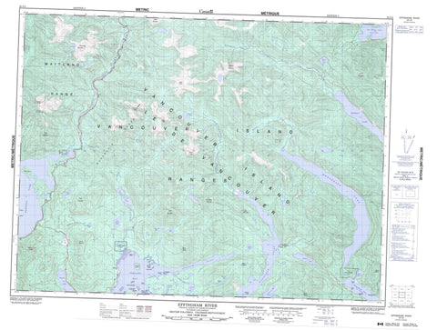
092F03 Effingham River Canada topo map, 1:50,000 scale
092F03 Effingham River NRCAN topographic map.
Includes UTM and GPS geographic coordinates (latitude and longitude). This 50k scale map is suitable for hiking, camping, and exploring, or you could frame it as a wall map.
Printed on-demand using high resolution, on heavy weight and acid free paper, or as an upgrade on a variety of synthetic materials.
Topos available on paper, Waterproof, Poly, or Tyvek. Usually shipping rolled, unless combined with other folded maps in one order.
- Product Number: NRCAN-092F03
- Parent Topo: TOPO-092F
- Map ID also known as: 092F03, 92F3, 92F03
- Unfolded Size: Approximately 26" high by 36" wide
- Weight (paper map): ca. 55 grams
- Map Type: POD NRCAN Topographic Map
- Map Scale: 1:50,000
- Geographical region: British Columbia, Canada
Neighboring Maps:
All neighboring Canadian topo maps are available for sale online at 1:50,000 scale.
Purchase the smaller scale map covering this area: Topo-092F
Spatial coverage:
Topo map sheet 092F03 Effingham River covers the following places:
- Cigarette Cove - Effingham Inlet - Mayne Bay - Pipestem Inlet - Port Alberni - Port Alberni Harbour - Snug Basin - Toquart Bay - Toquart Harbour - Two Rivers Arm - Uchucklesit Inlet - Vernon Bay - Caiger Point - Daller Point - Georgina Point - Harris Point - David Channel - Macoah Passage - Deekyakus Indian Reserve 2 - Elhlateese Indian Reserve 2 - Quinaquilth Indian Reserve 4 - Réserve indienne Deekyakus 2 - Réserve indienne Elhlateese 2 - Réserve indienne Quinaquilth 4 - Réserve indienne Winche 7 - Winche Indian Reserve 7 - Bazett Island - Enid Island - Hermit Islet - Hillier Island - Île de Vancouver - Image Island - Laylee Island - Pope Island - Refuge Island - Rocky Island - Shears Islands - Sisters Islands - Snowden Island - Stopper Islands - Vancouver Island - Webster Island - Amedroz Lake - Beckon Lake - Cataract Lake - Draw Lake - Effingham Lake - Ellswick Lake - Gracie Lake - Henderson Lake - Kennedy Lake - Kite Lake - Larry Lake - Little Toquart Lake - Maggie Lake - Mountain Woodfern Lake - Nahmint Lake - Redford Lake - Skull Lake - Sproat Lake - Toquart Lake - Uchuck Lake - 5040 Peak - Adder Mountain - Amedroz Mountains - Black Peaks - Cats Ears Peak - Draw Mountain - Handsome Mountain - Hidden Peak - Klitsa Mountain - Lucky Mountain - Mackenzie Range - Maitland Range - Mount Amedroz - Mount Anderson - Mount Aveline - Mount Dawley - Mount Hall - Mount Halliday - Mount Maitland - Mount Redford - Nahmint Mountain - Steamboat Mountain - The Cats Ears - The Limestone Twins - Triple Peak - Turret Mountain - Vancouver Island Mountains - Vancouver Island Ranges - Regional District of Alberni-Clayoquot - Clayoquot Plateau Park - Boulder Creek - Canoe Creek - Cass Creek - Cataract Creek - Cats Ears Creek - Clayoquot River - Clemens Creek - Coeur d'Alene Creek - Draw Creek - Effingham River - Gracie Creek - Gracie River - Kennedy River - Little Toquart Creek - Lucky Creek - Nahmint River - Redford Creek - Sand River - St. Dennis Creek - Toquart Creek - Toquart River - Uchuck Creek - Armentieres Rock - Armentières Rock - Black Patch Rocks - Blunden Rock - Kirby Rock - Pope Rocks - Arrowsmith - Kildonan


