
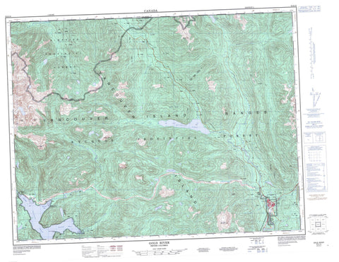
092E16 Gold River Canada topo map, 1:50,000 scale
092E16 Gold River NRCAN topographic map.
Includes UTM and GPS geographic coordinates (latitude and longitude). This 50k scale map is suitable for hiking, camping, and exploring, or you could frame it as a wall map.
Printed on-demand using high resolution, on heavy weight and acid free paper, or as an upgrade on a variety of synthetic materials.
Topos available on paper, Waterproof, Poly, or Tyvek. Usually shipping rolled, unless combined with other folded maps in one order.
- Product Number: NRCAN-092E16
- Parent Topo: TOPO-092E
- Map ID also known as: 092E16, 92E16
- Unfolded Size: Approximately 26" high by 36" wide
- Weight (paper map): ca. 55 grams
- Map Type: POD NRCAN Topographic Map
- Map Scale: 1:50,000
- Geographical region: British Columbia, Canada
Neighboring Maps:
All neighboring Canadian topo maps are available for sale online at 1:50,000 scale.
Purchase the smaller scale map covering this area: Topo-092E
Spatial coverage:
Topo map sheet 092E16 Gold River covers the following places:
- Head Bay - Moutcha Bay - Nesook Bay - Tlupana Inlet - Santa Saturnina Point - Perpendicular Bluff - Perpendicular Bluff - Nootka Land District - Moutcha Indian Reserve 5 - Nesuk Indian Reserve 4 - Réserve indienne Moutcha 5 - Réserve indienne Nesuk 4 - Réserve indienne Sucwoa 6 - Réserve indienne Tsa Xana 18 - Sucwoa Indian Reserve 6 - Tsa Xana 18 - Tsa Xana Indian Reserve 18 - Île de Vancouver - Vancouver Island - Alava Lake - Antler Lake - Bolton Lake - Bull Lake - Cala Lake - Deserted Lake - Dyke Lake - Frisco Lake - Gold Lake - Little Star Lake - Muchalat Lake - North Star Lake - Scout Lake - Twaddle Lake - Upana Lake - Vernon Lake - Big Baldy Mountain - Conuma Peak - Leighton Peak - Mount Alava - Mount Bate - Mount Grattan - Stevens Peak - Trio Mountain - Upana Mountain - Vancouver Island Ranges - Waring Peak - Regional District of Mount Waddington - Gold River Park - Gold-Muchalat Park - Strathcona Park - Alston Creek - Canton Creek - Conuma River - Cypress Creek - De Loriol Creek - East Waring Creek - Elbow Creek - Gold River - Heber River - Holiday Creek - Horseshoe Creek - Magee Creek - McCurdy Creek - McIver Creek - Muchalat River - Nesook River - Nimpkish River - Norgate Creek - Oktwanch River - Saunders Creek - Sebalhall Creek - Sucwoa River - Swah Creek - Tlupana River - Tolnay Creek - Trio Creek - Upana River - Ward Creek - Waring Creek - Muchalat - Canton Gorge - Quadra Saddle - Gold River


