
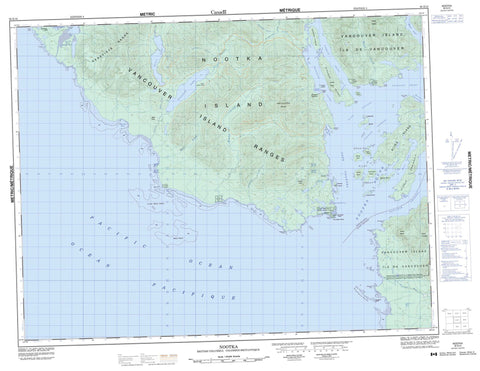
092E10 Nootka Canada topo map, 1:50,000 scale
092E10 Nootka NRCAN topographic map.
Includes UTM and GPS geographic coordinates (latitude and longitude). This 50k scale map is suitable for hiking, camping, and exploring, or you could frame it as a wall map.
Printed on-demand using high resolution, on heavy weight and acid free paper, or as an upgrade on a variety of synthetic materials.
Topos available on paper, Waterproof, Poly, or Tyvek. Usually shipping rolled, unless combined with other folded maps in one order.
- Product Number: NRCAN-092E10
- Parent Topo: TOPO-092E
- Map ID also known as: 092E10, 92E10
- Unfolded Size: Approximately 26" high by 36" wide
- Weight (paper map): ca. 55 grams
- Map Type: POD NRCAN Topographic Map
- Map Scale: 1:50,000
- Geographical region: British Columbia, Canada
Neighboring Maps:
All neighboring Canadian topo maps are available for sale online at 1:50,000 scale.
Purchase the smaller scale map covering this area: Topo-092E
Spatial coverage:
Topo map sheet 092E10 Nootka covers the following places:
- Boca del Infierno Bay - Ewin Inlet - Friendly Cove - Hisnit Inlet - Jewitt Cove - Kendrick Inlet - Louie Bay - Marvinas Bay - Nootka Sound - Nuchatlitz Inlet - Plumper Harbour - Resolution Cove - Santa Gertrudis Cove - Skuna Bay - Tahsis Inlet - Tlupana Arm - Tlupana Inlet - Third Beach - Bajo Point - Boston Point - Burdwood Point - Clerke Peninsula - Coopte Point - Discovery Point - Escalante Point - Ferrer Point - Hoiss Point - Maquinna Point - Salter Point - San Carlos Point - Tongue Point - Yuquot Point - Cook Channel - Eliza Passage - Fidalgo Passage - Hanna Channel - McKay Passage - Princesa Channel - Zuciarte Channel - Aass Indian Reserve 3 - Coopte Indian Reserve 9 - Hisnit Indian Reserve 7 - Hoiss Indian Reserve 8 - Réserve indienne Aass 3 - Réserve indienne Coopte 9 - Réserve indienne Hisnit 7 - Réserve indienne Hoiss 8 - Réserve indienne Tsarksis 2 - Réserve indienne Yuquot 1 - Tsarksis Indian Reserve 2 - Yuquot Indian Reserve 1 - Bligh Island - Bodega Island - Bold Island - Canal Island - Centre Islands - Clotchman Island - Escalante Island - Funter Island - Île de Vancouver - Matute Island - Narrow Island - Narvaez Island - Nootka Island - Pantoja Islands - Pass Island - Saavedra Islands - San Miguel Islands - San Rafael Island - Spanish Pilot Group - Spouter Island - Strange Island - Vancouver Island - Verdia Island - Vernaci Island - Villaverde Islands - AllmanLagoon - Cherry Lake - Crawfish Lake - Ewart Lake - Hoiss Lake - Bight Cone - Genevieve Mountains - Genevieve Range - James Cone - Mount Bauke - Mount Lombard - Mount Walker - Nootka Cone - North West Cone - Northwest Cone - Santa Cruz de Nuca Mountain - Vancouver Island Ranges - Regional District of Alberni-Clayoquot - Regional District of Comox-Strathcona - Bligh Island Marine Park - Santa Gertrudis-Boca del Infierno Park - Santa-Boca Park - Bajo Creek - Beano Creek - Bight Creek - Calipeen Creek - Callicum Creek - Calvin Creek - Cherry Creek - Cox Creek - Deserted Creek - Escalante River - Ewart Creek - Ewin Creek - Gunpowder Creek - Hoiss Creek - Kendrick Creek - Musket Creek - Bajo Reef - Escalante Rocks - Inner Bajo Reef - Kendrick Camp - Nootka - Plumper Harbour - Yuquot


