
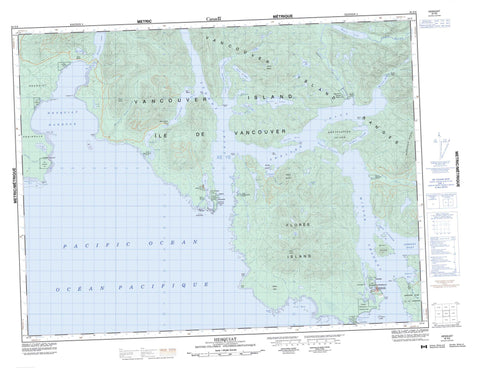
092E08 Hesquiat Canada topo map, 1:50,000 scale
092E08 Hesquiat NRCAN topographic map.
Includes UTM and GPS geographic coordinates (latitude and longitude). This 50k scale map is suitable for hiking, camping, and exploring, or you could frame it as a wall map.
Printed on-demand using high resolution, on heavy weight and acid free paper, or as an upgrade on a variety of synthetic materials.
Topos available on paper, Waterproof, Poly, or Tyvek. Usually shipping rolled, unless combined with other folded maps in one order.
- Product Number: NRCAN-092E08
- Parent Topo: TOPO-092E
- Map ID also known as: 092E08, 92E8, 92E08
- Unfolded Size: Approximately 26" high by 36" wide
- Weight (paper map): ca. 55 grams
- Map Type: POD NRCAN Topographic Map
- Map Scale: 1:50,000
- Geographical region: British Columbia, Canada
Neighboring Maps:
All neighboring Canadian topo maps are available for sale online at 1:50,000 scale.
Purchase the smaller scale map covering this area: Topo-092E
Spatial coverage:
Topo map sheet 092E08 Hesquiat covers the following places:
- Bacchante Bay - Bawden Bay - Boat Basin - Bottleneck Cove - Cow Bay - Dixon Bay - East Bay - Herbert Arm - Herbert Inlet - Hesquiat Harbour - Holmes Inlet - Homais Cove - Homeis Cove - Hootla-Kootla Bay - Hot Springs Cove - Matilda Inlet - North Arm - Pretty Girl Cove - Rae Basin - Refuge Cove - Riley Cove - Shelter Arm - Shelter Inlet - Siwash Cove - Smokehouse Bay - Steamer Cove - Stewardson Inlet - Sydney Inlet - Whitesand Cove - Young Bay - Hesquiat Bar - Adventure Point - Antons Spit - Base Point - Bawden Point - Belcher Point - Boulder Point - Clifford Point - Dagger Point - Dixon Point - Driver Point - East Entrance Point - Hesquiat Peninsula - Hesquiat Point - Kutcous Point - Le Claire Point - Matlahaw Point - McNeil Peninsula - Openit Peninsula - Rafael Point - Rondeault Point - Sharp Point - Split Cape - Starling Point - Yates Point - Hayden Passage - Rocky Passage - Ross Passage - Sulphur Passage - Hesquiat Indian Reserve 1 - Hisnit Fishery Indian Reserve 34 - Kutcous Point Indian Reserve 33 - Maahpe Indian Reserve 4 - Marktosis Indian Reserve 15 - Openit Indian Reserve 27 - Refuge Cove Indian Reserve 6 - Réserve indienne Hesquiat 1 - Réserve indienne Hisnit Fishery 34 - Réserve indienne Kutcous Point 33 - Réserve indienne Maahpe 4 - Réserve indienne Marktosis 15 - Réserve indienne Openit 27 - Réserve indienne Refuge Cove 6 - Réserve indienne Seektukis 24 - Réserve indienne Swan 35 - Réserve indienne Teahmit 3 - Réserve indienne Tequa 21 - Réserve indienne Tootoowiltena 28 - Réserve indienne Wappook 26 - Réserve indienne Watta 25 - Seektukis Indian Reserve 24 - Swan Indian Reserve 35 - Teahmit Indian Reserve 3 - Tequa Indian Reserve 21 - Tootoowiltena Indian Reserve 28 - Wappook Indian Reserve 26 - Watta Indian Reserve 25 - Clio Island - Cone Island - Darr Island - Flores Island - George Islands - Île de Vancouver - Kutcous Islets - Mate Islands - McKay Island - McKinn Island - McKinn Islets - Obstruction Island - Vancouver Island - Alto Lake - Camp Lake - Cecilia Lake - Easter Lake - Ellen Lake - Grenville Lake - Hesquiat Lake - Hisnit Lake - Ice Lake - Kanim Lake - Megin Lake - Pretty Girl Lake - Rae Lake - Riley Lake - Sheila Lake - Shiela Lake - Village Lake - Bourke Mountains - MacGregor Mountains - MacGregor Range - Mount Arthur - Mount Bourke - Mount Flores - Rafael Cone - Steamer Mountain - Vancouver Island Ranges - Regional District of Alberni-Clayoquot - Flores Island Park - Gibson Marine Park - Maquinna Marine Park - Maquinna Park - Sulphur Passage Park - Sydney Inlet Park - Atleo River - Bawden Creek - Cecilia Creek - Clay Creek - Cow Creek - Hesquiat Point Creek - Ice River - Megin River - Millar Channel - Purdon Creek - Riley Creek - Satchie Creek - Satchie River - Shelter Creek - Steamer Creek - Talbot Creek - Watta Creek - Barney Rocks - Canoe Reef - Canoe Rocks - Ramsay Hot Spring - Ahousat - Boat Basin - Hesquiat - Hesquiat - Hot Springs Cove - Marktosis - Stewardson Inlet - Round Saddle


