
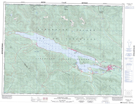
092C16 Cowichan Lake Canada topo map, 1:50,000 scale
092C16 Cowichan Lake NRCAN topographic map.
Includes UTM and GPS geographic coordinates (latitude and longitude). This 50k scale map is suitable for hiking, camping, and exploring, or you could frame it as a wall map.
Printed on-demand using high resolution, on heavy weight and acid free paper, or as an upgrade on a variety of synthetic materials.
Topos available on paper, Waterproof, Poly, or Tyvek. Usually shipping rolled, unless combined with other folded maps in one order.
- Product Number: NRCAN-092C16
- Parent Topo: TOPO-092C
- Map ID also known as: 092C16, 92C16
- Unfolded Size: Approximately 26" high by 36" wide
- Weight (paper map): ca. 55 grams
- Map Type: POD NRCAN Topographic Map
- Map Scale: 1:50,000
- Geographical region: British Columbia, Canada
Neighboring Maps:
All neighboring Canadian topo maps are available for sale online at 1:50,000 scale.
Purchase the smaller scale map covering this area: Topo-092C
Spatial coverage:
Topo map sheet 092C16 Cowichan Lake covers the following places:
- Gordon Bay - Honeymoon Bay - Marble Bay - McKenzie Bay - North Arm - Cowichan Lake Land District - Cowichan Lake Indian Reserve - Réserve indienne Cowichan Lake - Goat Island - Île de Vancouver - Vancouver Island - Bear Lake - Beaver Lake - Cowichan Lake - Delphi Lake - Fairservice Lake - Gillespie Lake - Grant Lake - Heather Lake - Kissinger Lake - Kwassin Lake - Lomas Lake - May Lake - McClure Lake - Mesachie Lake - Rheinhart Lake - Sherk Lake - Bald Mountain - El Capitan Mountain - Heather Mountain - Hill 60 Ridge - Mount Buttle - Mount Franklin - Mount Franklyn - Mount Good - Mount Holmes - Mount Landale - Mount Landalt - Mount Service - Mount Sutton - Mount Vernon - Mount Whymper - Seymour Range - Seymour Ridge - Towincut Mountain - Vancouver Island Mountains - Vancouver Island Ranges - Cowichan Valley Regional District - Gordon Bay Park - Lakeview Park - Nitinat River Park - Ashburnham Creek - Beaver Creek - Caycuse River - Chemainus River - Coonskin Creek - Cottonwood Creek - Cowichan River - Croft Creek - East Robertson River - Fairservice Creek - Golding Brook - Gordon River - Green Creek - Green River - Harrison Creek - Haslam Creek - Hauk Creek - Hinne Creek - Josiah Creek - Jump Creek - Loup Creek - March Creek - McKay Creek - Meade Creek - Millar Creek - Nanaimo River - Nineteen Creek - Nixon Creek - Oliver Creek - Raymond Creek - Redbed Creek - Reynard Creek - Rheinhart Creek - Robertson Creek - Robertson River - Shaw Creek - South Chemainus Creek - South Nanaimo River - Stanley Creek - Sutton Creek - Towincut Creek - Utility Creek - Vernon Creek - Wardroper Creek - Whisky-jack Creek - Widow Creek - Youbou Creek - Lake Cowichan - Caycuse - Gordon River - Honeymoon Bay - Mesachie Lake - Nitinat - Youbou


