
092C15 Little Nitinat River Canada topo map, 1:50,000 scale
092C15 Little Nitinat River NRCAN topographic map.
Includes UTM and GPS geographic coordinates (latitude and longitude). This 50k scale map is suitable for hiking, camping, and exploring, or you could frame it as a wall map.
Printed on-demand using high resolution, on heavy weight and acid free paper, or as an upgrade on a variety of synthetic materials.
Topos available on paper, Waterproof, Poly, or Tyvek. Usually shipping rolled, unless combined with other folded maps in one order.
- Product Number: NRCAN-092C15
- Parent Topo: TOPO-092C
- Map ID also known as: 092C15, 92C15
- Unfolded Size: Approximately 26" high by 36" wide
- Weight (paper map): ca. 55 grams
- Map Type: POD NRCAN Topographic Map
- Map Scale: 1:50,000
- Geographical region: British Columbia, Canada
Neighboring Maps:
All neighboring Canadian topo maps are available for sale online at 1:50,000 scale.
Purchase the smaller scale map covering this area: Topo-092C
Spatial coverage:
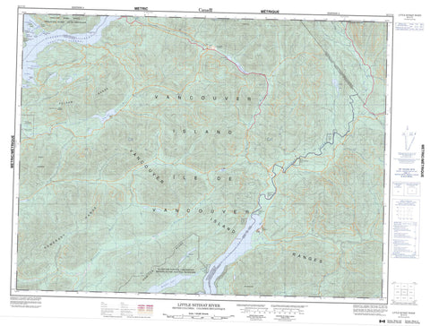
Topo map sheet 092C15 Little Nitinat River covers the following places:
- Alberni Inlet - Elhlateese Cove - Green Cove - Limestone Bay - Port Alberni - Port Alberni Harbour - Ritherdon Bay - San Mateo Bay - Uchucklesit Inlet - Blackstone Point - Brooksby Point - Burrough Point - Hissin Point - Knob Point - Pocahontas Point - Star Point - Strawberry Point - Chaputs Passage - Seekah Passage - Ship Passage - Nitinat Falls - Sarita Falls - Barclay Land District - Chuchummisapo Indian Reserve 15 - Cowishil Indian Reserve 1 - Homitan Indian Reserve 8 - Ilclo Indian Reserve 12 - Malachan Indian Reserve 11 - Numukamis Indian Reserve 1 - Opatseeah Indian Reserve 13 - Réserve indienne Chuchummisapo 15 - Réserve indienne Cowishil 1 - Réserve indienne Homitan 8 - Réserve indienne Ilclo 12 - Réserve indienne Malachan 11 - Réserve indienne Opatseeah 13 - Réserve indienne Saouk 16 - Réserve indienne Wokitsas 14 - Saouk Indian Reserve 16 - Wokitsas Indian Reserve 14 - Banton Island - Cheeyah Island - Île de Vancouver - Limestone Islet - Vancouver Island - Bewlay Lake - Consinka Lake - Darlington Lake - Flora Lake - Francis Lake - Hitchie Lake - Hobiton Lake - May Lake - McClure Lake - Nitinat Lake - Rosseau Lake - Sarita Lake - Tuck Lake - Hobiton Ridge - Mount Blenheim - Mount Grey - Mount Rosander - Pelham Mountains - Pelham Range - Poett Heights - Somerset Range - Vancouver Island Mountains - Vancouver Island Ranges - Cowichan Valley Regional District - Regional District of Alberni-Clayoquot - Hitchie Creek Park - Campus Creek - Carnation Creek - Caycuse River - Coleman Creek - Consinka Creek - East Klanawa River - Four Mile Creek - Granite Creek - Handy Creek - Hatton Creek - Hitchie Creek - Hobiton Creek - Jasper Creek - Klanawa River - Little Nitinat River - May Creek - Nitinat River - Parker Creek - Parsons Creek - Raymond Creek - Redbed Creek - Rift Creek - Ritherdon Creek - Sarita River - Seven Mile Creek - South Sarita River - Spencer Creek - Vernon Creek - Wilson Creek - Worthless Creek - Chris Rock - Franklin Camp - Green Cove - San Mateo


