
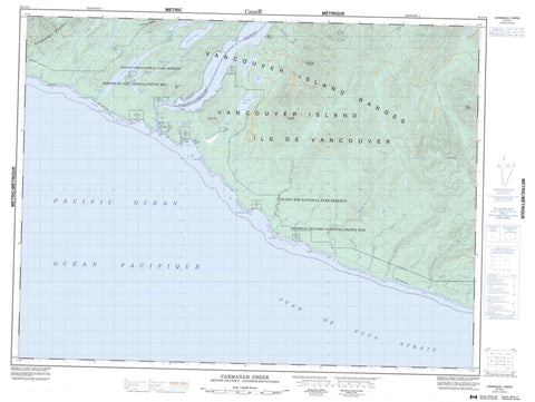
092C10 Carmanah Creek Canada topo map, 1:50,000 scale
092C10 Carmanah Creek NRCAN topographic map.
Includes UTM and GPS geographic coordinates (latitude and longitude). This 50k scale map is suitable for hiking, camping, and exploring, or you could frame it as a wall map.
Printed on-demand using high resolution, on heavy weight and acid free paper, or as an upgrade on a variety of synthetic materials.
Topos available on paper, Waterproof, Poly, or Tyvek. Usually shipping rolled, unless combined with other folded maps in one order.
- Product Number: NRCAN-092C10
- Parent Topo: TOPO-092C
- Map ID also known as: 092C10, 92C10
- Unfolded Size: Approximately 26" high by 36" wide
- Weight (paper map): ca. 55 grams
- Map Type: POD NRCAN Topographic Map
- Map Scale: 1:50,000
- Geographical region: British Columbia, Canada
Neighboring Maps:
All neighboring Canadian topo maps are available for sale online at 1:50,000 scale.
Purchase the smaller scale map covering this area: Topo-092C
Spatial coverage:
Topo map sheet 092C10 Carmanah Creek covers the following places:
- Brown Cove - Camper Bay - Cannery Bay - Clo-oose Bay - Cullite Cove - Daykins Bay - Dooches Bay - Mud Bay - Dare Beach - Nitinat Bar - Stanley Beach - Bonilla Point - Carmanah Point - Dare Point - Dickinsons Point - Martins Point - Tsuquadra Point - Tsuquanah Point - Tsusiat Point - Vancouver Point - Whyac Point - Juan de Fuca Strait - Nitinat Narrows - Limestone Bluffs - Valencia Bluffs - Tsusiat Falls - Ahuk Indian Reserve 1 - Carmanah Indian Reserve 6 - Cheewat Indian Reserve 4A - Claoose Indian Reserve 4 - Cullite Indian Reserve 3 - Doobah Indian Reserve 10 - Iktuksasuk Indian Reserve 7 - Oyees Indian Reserve 9 - Réserve indienne Ahuk 1 - Réserve indienne Carmanah 6 - Réserve indienne Cheewat 4A - Réserve indienne Claoose 4 - Réserve indienne Cullite 3 - Réserve indienne Doobah 10 - Réserve indienne Iktuksasuk 7 - Réserve indienne Oyees 9 - Réserve indienne Sarque 5 - Réserve indienne Tsuquanah 2 - Réserve indienne Wyah 3 - Sarque Indian Reserve 5 - Tsuquanah Indian Reserve 2 - Wyah Indian Reserve 3 - Île de Vancouver - Vancouver Island - Blue Lake - Cheewhat Lake - Clo-oose Lake - Doobah Lake - Glad Lake - Hobiton Lake - Little Squalicum Lake - Little Tsusiat Lake - McClure Lake - Nitinat Lake - Oyees Lake - Sprise Lake - Squalicum Lake - Tsuquadra Lake - Tsusiat Lake - Carmanah Mountain - Hobiton Ridge - House Cone - Mount Walbran - Nitinat Cone - Nitinat Hill - Smokehouse Mountain - Somerset Range - Vancouver Island Mountains - Vancouver Island Ranges - Capital Regional District - Cowichan Valley Regional District - Regional District of Alberni-Clayoquot - Carmanah Pacific Park - Carmanah Walbran Park - Pacific Rim National Park Reserve of Canada - Réserve de parc national du Canada Pacific Rim - 150 Yard Creek - Adrenaline Creek - August Creek - Billy Goat Creek - Blue Creek - Bonilla Creek - Bugaboo Creek - Camper Creek - Carmanah Creek - Cheewhat River - Clo-oose Creek - Coal Creek - Cribs Creek - Cullite Creek - Doobah Creek - Hatton Creek - Hobiton Creek - Kalide Creek - Klanawa River - Kulaht Creek - Logan Creek - Marchand Creek - Nitinat River - Sandstone Creek - Squalicum Creek - Trestle Creek - Trisle Creek - Tsocowis Creek - Tsusiat River - Walbran Creek - West Coast Trail - Swiftsure Bank - Clo-oose - Whyac


